NASA's Landsat 8 Captures Stunning Vortex Streets Near Antarctica
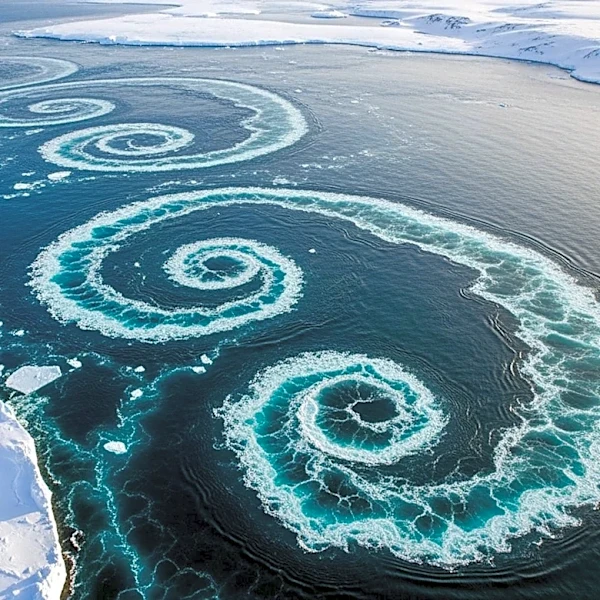
NASA's Landsat 8 satellite has captured a striking image of von Kármán vortex streets near Peter I Island in the Southern Ocean. This phenomenon occurs when strong winds, known as the Roaring Forties, Furious Fifties, and Screaming Sixties, encounter obstacles like islands, causing the airflow to deflect and form counterrotating spirals. The image, taken on February 11, 2026, shows these spirals forming downwind of the ice-cloaked volcanic island, which is located 400 kilometers off the coast of West Antarctica. The island, discovered in 1821 by Russian explorer Fabian Gottlieb von Bellingshausen, is known for its challenging ice conditions and remote location, which have limited scientific research. The island's summit features a 100-meter-wide crater, and while it is described as a shield-like volcano, there are no records of recent eruptions.