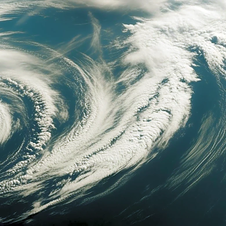
NASA Satellite Captures Striking Cloud Formations Over Gulf of Alaska
NASA's Terra satellite, equipped with the MODIS instrument, captured a striking image of cloud formations over the Gulf of Alaska on March 19, 2026. This image, taken on the last day of astronomical winter, shows a complex interaction of atmospheric conditions. A low-pressure system over the Gulf combined with high pressure over eastern Russia and northern Alaska, causing cold Arctic air to flow southeast over the Alaska Peninsula. This led to the formation of cloud streets, which are parallel bands of clouds that form when cold, dry air moves over warmer ocean water, picking up moisture and heat. The image also shows von Kármán vortex streets, which are staggered, swirling cloud patterns formed when winds are diverted around elevated areas like islands. Additionally, a polar low, a small cyclonic formation, was observed southwest of Anchorage, bringing tropical storm-force winds and snow.