El Niño Strengthens to 'Super El Niño' Status, Expected to Impact U.S. Winter Weather
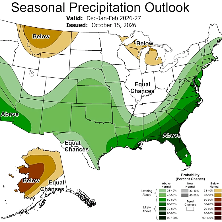
El Niño, a natural climate pattern characterized by warmer-than-average sea surface temperatures in the tropical Pacific Ocean, has intensified to 'Super El Niño' status. This designation occurs when sea surface temperature anomalies in the tropical Pacific exceed 2.0°C, a threshold that has been met with reported anomalies of 2.5°C. This year's event is considered exceptionally strong, with the National Oceanic and Atmospheric Administration (NOAA) projecting an over 80% chance it could be the strongest since 1950. The phenomenon, named by Peruvian fishermen for its tendency to appear around Christmas, is expected to persist into early 2027. Its influence extends globally, affecting the jet stream and weather patterns across the United States, leading to questions about its impact on winter temperatures, snowfall, and storms. The El Niño-Southern Oscillation (ENSO) cycle, which includes El Niño and its cooler counterpart La Niña, is the largest driver of year-to-year weather variability worldwide.