NASA's Nisar Satellite Tracks Mexico City's Rapid Sinking, Highlighting Infrastructure Risks
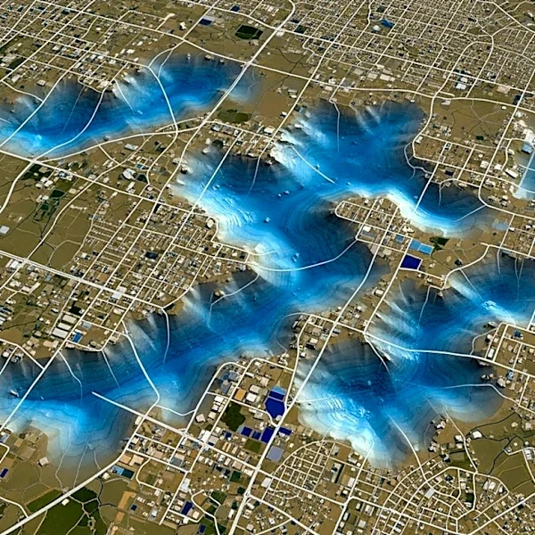
Mexico City is experiencing significant subsidence, sinking at a rate of up to 2 centimeters per month, as revealed by NASA's Nisar satellite. This phenomenon, primarily caused by excessive groundwater extraction, affects the city's infrastructure, including roads, buildings, and the metro system. The Nisar satellite, a joint project between NASA and the Indian Space Research Organisation, provides detailed radar imaging that tracks these changes in real-time. The data shows that areas like the city's main airport are among the most affected. The subsidence has been ongoing for over a century, with the city's soft soil, originally an ancient lake bed, compacting as water is withdrawn from the aquifer below.