US State Department's AI-Generated Map Error at Brazil Conference Sparks Controversy
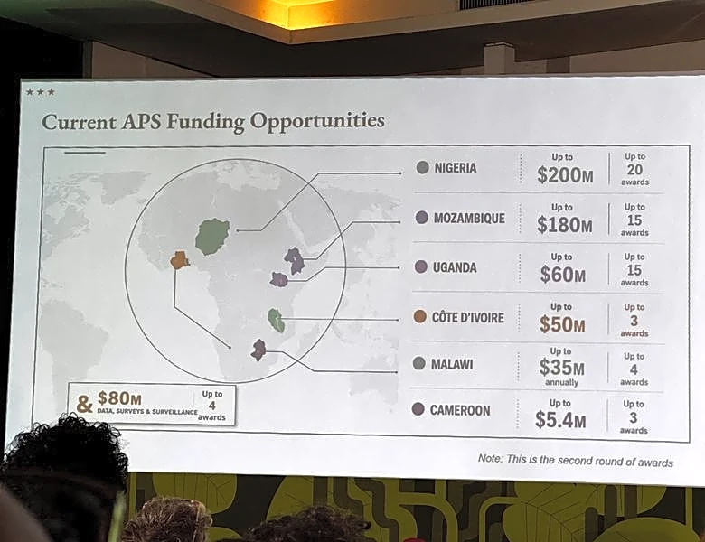
The US State Department faced criticism after presenting an AI-generated map at the AIDS 2026 conference in Rio de Janeiro, Brazil, which incorrectly labeled and misplaced several African countries. The map, created using OpenAI tools, showed Nigeria as a landlocked country in the Sahara Desert, Mozambique in the Horn of Africa, and Ivory Coast on the opposite side of the continent. The presentation, delivered by Jeff Graham, a senior US health official, was part of updates on new health agreements. The map's inaccuracies were first highlighted by AIDS researcher Emily Bass on Substack and quickly spread across social media, garnering significant attention. The State Department has accepted responsibility for the error, acknowledging the confusion and misrepresentation it caused among attendees, including African partners. Despite the incident, the department emphasized that discussions at the conference remained substantive and constructive, reaffirming its commitment to global HIV/AIDS efforts.