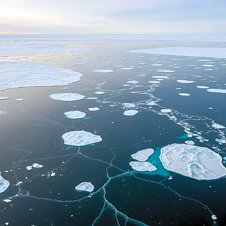
NASA Observes Record Low Arctic Sea Ice in Barents Sea
NASA's Terra satellite has captured images of the northern Barents Sea, revealing thin and broken-up sea ice with areas of open water. This observation comes after the Arctic sea ice reached its annual maximum extent on March 15, 2026, matching the lowest maximum recorded since satellite monitoring began in 1979. The Barents Sea, located at the periphery of the Arctic Ocean, is a critical region for fisheries, shipping routes, and scientific research. The low sea ice extent is attributed to large-scale atmospheric circulation, with winds channeling warm, humid air from the North Atlantic into the area, accelerating the melt. This phenomenon is influenced by tropical weather disturbances originating over the Maritime Continent near Indonesia.