NASA Observes Ice Breakup on Kuskokwim River, Raising Flood Concerns in Aniak, Alaska
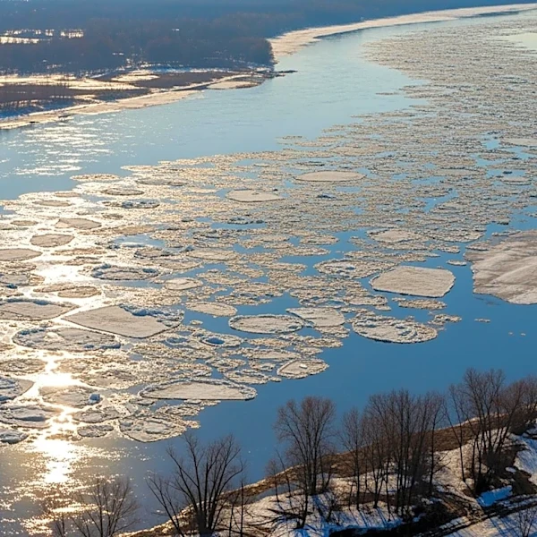
NASA's Earth Observatory has captured significant changes along the Kuskokwim River near Aniak, Alaska, as the region transitions from winter to spring. Images taken by the Landsat 9 satellite show the river's ice cover beginning to break up between April 21 and May 7, 2026. The breakup of river ice, a common spring occurrence, poses a risk of flooding in low-lying areas. The Alaska-Pacific River Forecast Center reported that the river ice was thick and covered in snow as of mid-April, supporting a 350-mile ice road that closed on April 10. By early May, the ice breakup had reached Aniak, causing a 21-mile ice jam upstream. Although the ice began to move downstream by May 7, the town remained at risk as ice jams formed downstream, prompting a flood watch on May 8. Water levels rose, affecting homes and businesses near the runway before receding two days later.