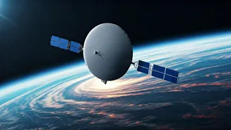

Understanding NISAR
NISAR, which stands for NASA-ISRO Synthetic Aperture Radar, is a joint mission between the National Aeronautics and Space Administration (NASA) and the Indian
Space Research Organisation (ISRO). It represents a remarkable synergy of technological prowess and international collaboration. This satellite carries advanced radar systems designed to observe Earth's surface with unparalleled precision. Its primary objective is to provide comprehensive data on a variety of Earth processes, including ecosystem disturbances, ice sheet dynamics, natural hazards, and solid Earth science. The mission is a testament to the value of global partnerships in tackling complex scientific challenges, paving the way for a deeper comprehension of our planet. As the project is being prepared for launch, the anticipation for the data it will provide continues to grow.
Global Collaboration's Role
The existence of NISAR clearly indicates the fundamental role of international collaborations in high-level science. The project brings together the expertise, resources, and technologies of NASA and ISRO. NASA is contributing its advanced radar technology, while ISRO is providing the launch vehicle and spacecraft. This integrated approach boosts the mission's effectiveness, enabling it to capture a wider spectrum of data. These data include critical insights into environmental changes, natural disasters, and the physical state of the Earth's surface. This collaborative model enables both space agencies to achieve more than they could separately. It also opens doors to innovation by exchanging different methodologies and technological perspectives. The sharing of scientific knowledge is not just an ancillary benefit, but a central pillar of such international ventures, fueling progress.
Technological Innovation
At its core, NISAR represents a massive leap in radar technology. The satellite is equipped with two synthetic aperture radar instruments that operate at different microwave frequencies, namely L-band (NASA) and S-band (ISRO). This dual-frequency approach allows for highly detailed observations of Earth. It allows researchers to study changes in the Earth's surface, from subtle shifts in the land to the movement of glaciers and the effects of natural hazards like earthquakes and volcanic eruptions. NISAR will scan the entire Earth every 12 days. The precision and breadth of the data collected promise to revolutionize how we monitor and understand our planet. The mission's technological capabilities have the potential to impact fields like environmental science, disaster management, and climate research. Moreover, the project will offer a detailed view of how various Earth systems interact. It will contribute to a better grasp of climate change effects and promote more effective responses to global challenges.
Data and Impact
The data collected by NISAR will have significant and far-reaching implications. Scientists worldwide are eager to analyze the data, expecting to deepen their understanding of various Earth processes. These processes include ecosystem changes, which will provide information to understand the impacts of deforestation and how to protect fragile environments. It will also monitor ice sheet dynamics, which is crucial for understanding sea level rise, providing critical data for predicting and mitigating the effects of climate change. Furthermore, the mission is expected to enhance our ability to predict and respond to natural disasters such as earthquakes and volcanic eruptions. The comprehensive dataset will be accessible to the international scientific community, promoting further research and discoveries. This open-source approach ensures maximum utility and facilitates widespread application of the mission’s findings.