Mapping the Depths
Until recently, subsurface surveys faced limitations in spatial resolution, restricting their scope to areas near the surface. However, this study, led
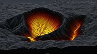
by Tsuji and colleagues, broke new ground by producing a detailed, high-resolution “digital map” of deep geothermal reservoirs. The team utilized three-dimensional multichannel seismic surveys to image geothermal structures, specifically in the Kuju volcanic group in Japan. They employed a novel method, known as extended Common Reflection Surface (CRS) stacking, to analyze the images. This approach allowed the researchers to visualize deeper features, including magma-related structures, fluid pathways along fractures, and rock layers acting as seals for supercritical fluids. This detailed imaging allows for a better understanding of the processes occurring deep within the earth.
Geothermal Insights
The research concentrated on the brittle-ductile transition zone, the area where rock transitions from being seismically active to largely inactive. This zone is critical to understanding volcanic and geothermal processes, as it's near an impermeable sealing band where fluids, such as water, accumulate in a high-pressure, supercritical state. According to Tsuji, the clear images of fluid locations and movements enable the identification of promising drilling locations and the design of safer and more efficient development plans. This has implications for expanding geothermal power generation, decreasing reliance on fossil fuels, and supporting carbon neutrality and energy security. The research team also used advanced seismic tomography and machine-learning-based analyses to ascertain the seismic velocity of specific structures and earthquake mechanisms with a high degree of accuracy. This integrated strategy enabled the team to image a deep geothermal system in unprecedented detail.
Focus on Kuju
The Kuju area, chosen as the study site, is known for its volcanic activity, with eruptions occurring approximately 1600 years ago, and intermittent eruptions in recent years. This region also hosts two significant geothermal power plants, Hatchobaru and Otake. The Hatchobaru plant stands out as the largest geothermal facility in Japan, boasting a capacity of 110 MW. The region’s geothermal reservoir contains water, originating as precipitation, which is heated underground before moving westward through the fault system. Until now, obtaining detailed images of the magmatic structures and fluid pathways was impossible, but this recent study has changed that. The researchers are planning to deploy portable seismic sources and sensors in mountainous areas to examine the shallower parts of geothermal systems in greater detail. Future surveys will extend to other geothermal fields to test the method's general applicability.
Future Implications
The study's findings have implications for both earthquake early warning systems and the development of advanced geothermal power technologies. The research provides a scientific basis for the large-scale deployment of supercritical geothermal power as a sustainable energy source. Tsuji believes that the results offer the scientific and technical foundation for next-generation supercritical geothermal power. He noted the underutilization of geothermal power in Japan, despite its abundant volcanic and thermal resources. This research is likely to revolutionize the way we utilize geothermal energy in the future. The ability to map these resources accurately allows for safer and more sustainable energy development and production. The study highlighted the importance of a detailed understanding of the complex subsurface features.


