


NISAR: A Collaboration
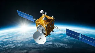
The NISAR satellite represents a monumental collaboration between NASA and the Indian Space Research Organisation (ISRO). This joint mission highlights
the commitment of both space agencies to advance our understanding of Earth. The satellite is designed to monitor Earth's surface and various environmental changes. Its advanced instruments will provide comprehensive data crucial for studying climate change, natural hazards, and ecosystem dynamics. This partnership emphasizes a shared goal of leveraging space technology for global benefit, fostering international cooperation in the field of Earth science.
Satellite's Capabilities Explored
NISAR is equipped with advanced radar systems, including L-band and S-band synthetic aperture radars. This dual-frequency radar system allows NISAR to penetrate clouds and vegetation, providing detailed imagery of Earth's surface regardless of weather conditions. The data collected by NISAR will offer a wealth of information, from tracking ice sheet movement to monitoring changes in vegetation. The satellite's unique capabilities make it a vital tool for environmental monitoring, providing insights into various natural processes and their impacts. This will allow scientists to study Earth's systems with unprecedented precision and detail, enabling better predictions of climate change impacts.
Mission's Key Objectives
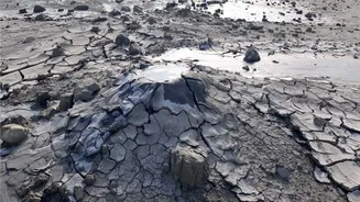
The primary objectives of the NISAR mission focus on understanding Earth's complex processes and supporting environmental stewardship. The satellite aims to monitor changes in ecosystems, track the movement of glaciers and ice sheets, and observe natural hazards such as earthquakes and volcanoes. NISAR's data will provide valuable insights into climate change impacts, helping scientists better understand the dynamics of our planet. This includes monitoring the effects of rising sea levels, changes in land use, and the impact of extreme weather events. The mission's success will contribute significantly to our knowledge of Earth's environment.
Data and Applications
The data collected by NISAR will have broad applications across various scientific disciplines. Researchers will use the satellite's imagery to study changes in land cover, deforestation, and agricultural practices. The data will also be essential for monitoring the impact of natural disasters, enabling better disaster response and mitigation strategies. Furthermore, NISAR data will contribute to understanding global water cycles, improving weather forecasting, and tracking the effects of climate change. This information will empower policymakers and scientists to make informed decisions regarding environmental protection and sustainable resource management, ultimately aiding global efforts to address the climate crisis.
NISAR's Impact Assessed
The launch and operation of the NISAR satellite is expected to have a profound impact on our understanding of Earth and its environment. By providing unprecedented data on various Earth processes, NISAR will help scientists develop more accurate climate models and improve predictions of future environmental changes. The mission's data will also support sustainable development initiatives, helping to manage natural resources more effectively. NISAR is set to become an essential tool for environmental monitoring, enabling the scientific community to track changes with remarkable precision and provide insights into the planet's evolving systems. The insights gained from the mission will contribute significantly to global efforts to address climate change and promote a sustainable future.