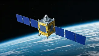


NISAR: A Partnership
The NISAR satellite project represents a significant collaborative endeavor between the National Aeronautics and Space Administration (NASA) of the United
States and the Indian Space Research Organisation (ISRO). This joint effort highlights the global cooperation in space exploration and earth science. It signifies a convergence of technological expertise and resources from two leading space agencies. The primary objective is to develop a satellite equipped with advanced radar technology capable of providing detailed observations of Earth's surface. This data will be instrumental in studying various environmental changes, including climate change, natural hazards, and ecosystem dynamics. This partnership underlines the collective commitment to understanding our planet and addressing critical global challenges. The satellite is a testament to the benefits of international collaboration in scientific advancement.
Mission's Scientific Goals
NISAR is designed to monitor Earth's surface with unprecedented precision using advanced radar imaging. The mission's primary scientific goals include mapping changes in the Earth's ecosystems, assessing the impact of natural hazards like earthquakes and volcanic eruptions, and understanding the dynamics of the Earth's ice sheets and glaciers. The satellite will provide critical data on climate change, tracking shifts in sea levels, and monitoring variations in vegetation and land use. This information will enable scientists to gain deeper insights into the complex interactions between the Earth's systems. This comprehensive dataset will significantly enhance climate models and help in predicting environmental changes. The high-resolution observations will also aid in improving disaster management and mitigating the effects of natural disasters worldwide.
Radar Technology Explained
The core of NISAR's capabilities lies in its Synthetic Aperture Radar (SAR) technology. This system uses radar signals to create high-resolution images of the Earth's surface, even through clouds and darkness. The satellite carries two SAR instruments operating at different frequencies: L-band, provided by NASA, and S-band, provided by ISRO. These dual-frequency bands allow for a comprehensive analysis of the Earth's surface. The L-band radar is particularly effective at penetrating through vegetation, providing detailed data about forest structure and biomass. The S-band radar provides valuable information about ground deformation, crucial for monitoring earthquakes and volcanic activity. The combination of these two bands enhances the accuracy and range of the observations, offering a unique perspective on the planet's dynamics. The advanced radar technology is a key factor in the satellite's ability to gather critical data for environmental research and climate studies.
Global Impact & Future
The data collected by NISAR will have a profound impact on several sectors, including climate science, disaster management, and resource management. The mission's findings will help researchers understand climate change trends, improve predictions, and develop effective mitigation strategies. In disaster-prone regions, the data will aid in early warning systems and damage assessment. The information gathered about land use and water resources will support sustainable development practices. NISAR’s observations are expected to contribute to a better understanding of the global environment. The mission's success will set a precedent for future collaborative space projects and further advance our ability to study and protect the Earth. The wealth of information generated by the satellite will be a valuable resource for scientists, policymakers, and communities worldwide.