


Gamers Powering Robots
What began as a global phenomenon of players venturing outdoors to find virtual creatures has evolved into a significant contribution to real-world technological
advancement, specifically in the field of robotics. The extensive collection of ground-level imagery voluntarily submitted by Pokémon Go enthusiasts over the past decade has proven to be an invaluable resource for robotics companies. This vast dataset, comprising approximately 30 billion images capturing public spaces, street views, and urban intersections, is now instrumental in training sophisticated delivery systems. These systems are being deployed in cities across the United States and internationally, marking a fascinating intersection of gaming and practical artificial intelligence, all driven by the collective efforts of millions of game participants who inadvertently became data contributors.
Building a Digital World
Niantic Spatial, an enterprise focused on AI and mapping technologies that emerged from the creators of Pokémon Go, has ingeniously transformed this player-generated visual data into a highly detailed, dynamic street-level digital map. This photorealistic model is specifically engineered to facilitate robotic navigation. The process involves meticulously converting the crowdsourced photographs and short videos into a continuously updated representation of the physical world. This living map is crucial for enabling robots to perceive their surroundings accurately, understand spatial relationships, and make informed decisions as they move through complex urban environments. The sheer scale of data, accumulated over many years of gameplay, provides an unparalleled level of detail and variety, essential for robust AI training.
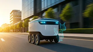
Robots Navigating Cities
This advanced mapping technology is already powering a considerable fleet of delivery robots. For instance, Coco Robotics utilizes this system to operate around 1,000 delivery bots across major cities like Los Angeles, Chicago, Miami, Jersey City, and even in Helsinki. These autonomous units have collectively covered millions of miles performing deliveries, demonstrating the practical efficacy of the AI-driven navigation. Brian McClendon, Chief Technology Officer at Niantic Spatial and a key figure in the development of Google Earth, elaborated on their data strategy. He explained that the high-quality, ground-level data from game players serves as exceptional training material for other, less precise datasets. The long-term vision is to leverage concentrated, high-quality data to train models for complex tasks like localization, reconstruction, and understanding environmental semantics, which can then be applied more broadly using lower-resolution, readily available data.
Overcoming GPS Limits
Niantic Spatial's innovative approach also addresses a critical limitation of current navigation systems: the unreliability of GPS in dense urban settings. The tall buildings characteristic of cities often disrupt satellite signals, making precise location tracking difficult. To counter this, Niantic Spatial has developed a Visual Positioning System (VPS). This system bypasses GPS dependency by comparing real-time camera feeds from robots or devices with its extensive image database. By cross-referencing live visuals with its detailed, constantly updated map, the VPS can accurately determine a robot's exact position and orientation, even in signal-challenging environments. A spokesperson confirmed that the model operates in real time, integrating data from the robot’s cameras with both public and proprietary datasets to establish precise global positioning and heading, proving particularly resilient in what are known as 'urban canyons'.
Enhancing Delivery Accuracy
The reliance on player-submitted scans for the initial training of the VPS highlights the power of crowdsourcing. While the system has since expanded to include data from enterprise users, the foundation was built on voluntary contributions from the gaming community. This comprehensive dataset, comprising billions of images, enables the creation of 3D environmental reconstructions, precise localization, and a deep semantic understanding of surroundings—effectively building a 'living, breathing map' designed for robots and AI. This is crucial for delivery services, as highlighted by Zach Rash, CEO of Coco. He pointed out that robots currently lack the human intuition to navigate when GPS fails, leading to potentially poor customer experiences if orders are delivered to the wrong location. The VPS, by offering superior accuracy in dense urban areas where traditional GPS falters, directly tackles this issue, ensuring a smoother and more reliable delivery process for customers and improving overall service satisfaction.