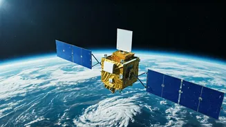
NISAR's Grand Vision
The NASA-ISRO Synthetic Aperture Radar (NISAR) mission stands as a significant collaboration between the National Aeronautics and Space Administration
(NASA) of the United States and the Indian Space Research Organisation (ISRO). This mission is designed to employ advanced radar technology to measure changes in Earth's surface with unprecedented precision. The primary objective of NISAR is to observe and understand various Earth processes, including ecosystems, ice masses, and natural hazards. The satellite's data will enable scientists to monitor and study these dynamic systems, contributing to a deeper comprehension of climate change and environmental challenges. NISAR's design incorporates two radar systems: an L-band radar from NASA and an S-band radar from ISRO. These dual-band radars will provide detailed information about Earth's surface, offering insights into its composition, movement, and changes over time.
Dual-Band Radar Advantage
The use of both L-band and S-band radar is a crucial aspect of NISAR's design, enhancing its capabilities significantly. The L-band radar, provided by NASA, is particularly adept at penetrating through clouds and vegetation, allowing it to collect data in various weather conditions and across diverse terrains. The S-band radar, developed by ISRO, provides complementary data, improving the overall accuracy and resolution of the measurements. This dual-band approach allows NISAR to capture a comprehensive view of Earth's surface, providing information on the movement of ice sheets, changes in vegetation cover, and the impact of natural disasters such as earthquakes and volcanic eruptions. The combined data from both radars will improve the accuracy of the satellite's observations, leading to a much more detailed understanding of Earth's dynamic processes. This also will enable scientists to create more accurate predictive models for climate change and natural hazards.
Observing Earth's Changes
NISAR's primary goal is to study various Earth processes. The satellite will monitor the behavior of ice sheets and glaciers, providing data on their melting rates and contribution to sea-level rise. By measuring the displacement of land surfaces, NISAR can also provide information on earthquakes, volcanic eruptions, and landslides, aiding in disaster management and risk assessment. The satellite will also monitor vegetation, mapping forest cover, and assessing the impact of deforestation and land-use changes. Additionally, NISAR can study ecosystems, monitoring changes in wetlands, coastal regions, and agricultural areas. This detailed information will assist in understanding the complex interactions between Earth's different systems and the influence of climate change, allowing for a better understanding of our planet. This helps to prepare for natural disasters, and to study the growth and changes of our vegetation.
Impact and Future
The data collected by NISAR will be a vital resource for a broad array of scientific studies. It will support research on climate change, helping scientists to develop more accurate models and predictions. The satellite's data will also be useful for studying the impacts of natural hazards, providing insights into their causes and effects, and assisting in developing more effective mitigation strategies. The mission is expected to contribute to a better understanding of ecosystems and biodiversity. NISAR's launch is scheduled in the near future, marking a significant step in Earth observation and environmental monitoring. The data from NISAR will be publicly available, enabling scientists and researchers worldwide to conduct detailed studies and contribute to a better understanding of our planet. The collaborative efforts between NASA and ISRO show the international importance of this mission.


