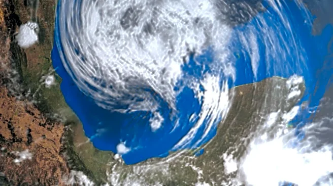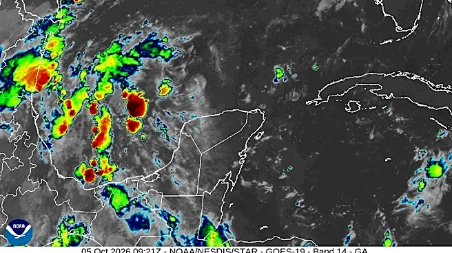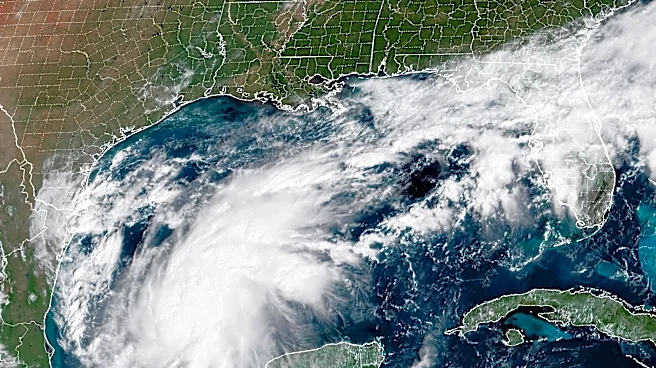


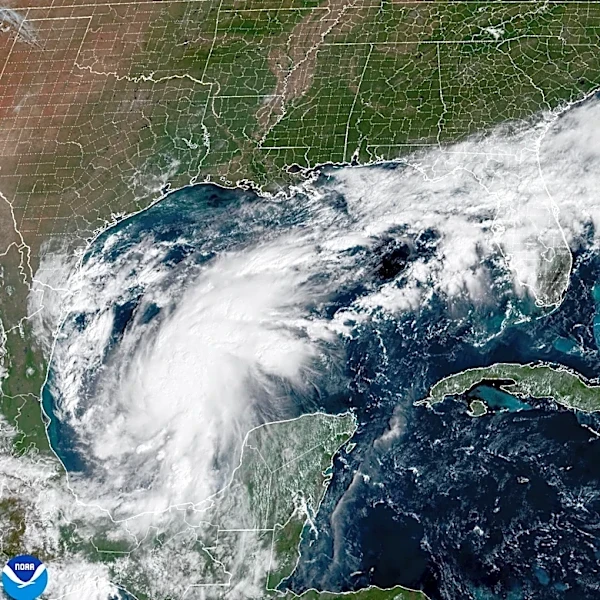




The super El Nino has been a nonstop machine cranking out tropical storms that have seemingly rolled through the Pacific region like rush-hour traffic. Now, it's the U.S. Gulf Coast's turn.
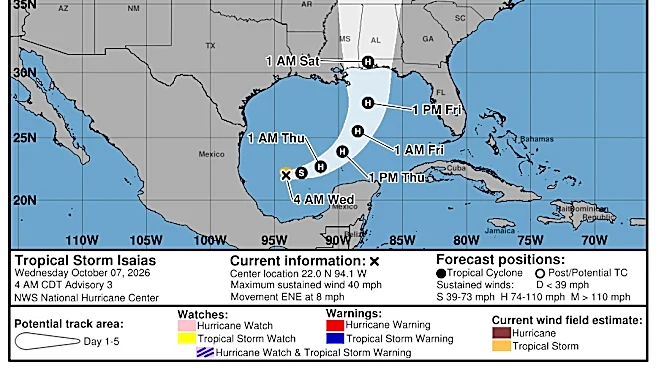
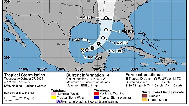
One of the strongest El Nino years on record meant a quiet first four months of the Atlantic hurricane season, but that's no longer the case. Tropical Storm Isaias, which formed Wednesday, is expected to gain hurricane strength by Thursday before moving onshore.
If that happens, it would tie a 121-year-old record for the latest-forming initial hurricane of the Atlantic season. That mark was set on Oct. 8, 1905, according to the National Weather Service.
Isaias is the ninth named storm of the season. None of the previous ones reached hurricane strength. A normal hurricane season has 14 named storms, seven of them becoming hurricanes and three of them reaching major hurricane level, which is more than 110 mph (177 kph).
“The season has been completely dead — and we’re still going to have an impactful storm hitting the northern Gulf,” Colorado State University hurricane expert Phil Klotzbach said Wednesday. “How impactful it is remains to be seen.”
El Nino involves a natural, temporary warming of parts of the equatorial Pacific, setting off a chain of unusual weather around much of the world. While it's one of many factors in play in the formation of Isaias, the current El Nino "still is certainly driving the bus," Klotzbach said.
Water temperatures in the Gulf right now are “super hot” and are considered “rocket fuel for hurricanes,” he said. Another contributor is the ongoing natural seasonal weather pattern that moves around the globe every 30 or so days called the Madden-Julian Oscillation.
Still, overall Atlantic hurricane activity, using a measurement that deals with the number of storms, their strength and how long they last, is on track to be the quietest since modern data started around 1950, thanks to El Nino, which could become the strongest one ever recorded, Klotzbach said.
During El Nino, low-level surface winds blowing from east to west across the Pacific are weakened or sometimes reversed. It causes a shift in the jet stream and drives record global heat, severe droughts, wildfires and shrinking water supplies. El Nino also typically curtails hurricane activity in the Atlantic basin. When tropical systems form in the Pacific Ocean during El Ninos, that increases wind shear in the Caribbean, making it difficult for storms to form there.
But now, the wind shear in the Gulf has weakened a bit compared with other tropical regions, so the Gulf is “a little more primed for development,” said Lindsey Long, a meteorologist with the U.S. National Oceanic and Atmospheric Administration’s Climate Prediction Center.
“It’s actually not that surprising that we’re starting to see some development in the Gulf at this time of year,” Long said. “It only takes one storm for a lot of possible destruction. So you don’t want to put your guard down.”
Notable hurricanes that have hit the eastern United States during an El Nino include Lili in 2002, Ivan in 2004 and Idalia in 2023.
Hurricane Andrew, the first named storm of the 1992 Atlantic hurricane season, didn’t form until August. It caused 65 deaths and more than $26 billion in damage across Florida, Louisiana and the Bahamas. An El Nino that started the previous winter continued through the spring and into the summer of 1992.
When Andrew formed, Long said, the world was transitioning into a neutral condition when it comes to the important natural El Nino Southern Oscillation, which warps weather systems worldwide. Neutral is when weather gets closer to long-term averages or normal.
During the modern satellite era that began in the mid-1960s, there has never been a year in which no hurricanes formed in the Atlantic basin. And "it doesn’t look like it’s going to happen this year, either,“ Long said.
Before satellites arrived, there were a few years when no Atlantic hurricanes were recorded, but some storms out at sea could have been missed and records were less reliable, she said.
Since the start of the satellite era, the latest date for the first Atlantic hurricane to form was Sept. 11, both in 2002 and 2013, the weather service said. Isaias is expected to topple that.
This year’s Atlantic hurricane season had already set a record for the longest a season has advanced without a storm that reached winds of 74 mph (119 kph) to qualify as a hurricane — at least in the satellite era — said Nick Novella, a meteorologist at the Climate Prediction Center.
The biggest threat for storm surge and initial flash flood risk over the next 48 hours is from the mouth of the Mississippi River in southeast Louisiana to Yankeetown, Florida, north of Tampa.
Hurricane-force winds are anticipated over the Florida Panhandle, through the Alabama coast and on to Bay St. Louis, Mississippi. Flash flood risks on Saturday and Saturday night go as far north as Memphis, Tennessee, according to the weather service.