


California officials and weather forecasters urged holiday travelers to avoid the roads and reconsider Christmas travel as a series of powerful winter storms brought relentless rains, heavy winds and mountain snow.
Storms began to move in late Tuesday evening and were expected to intensify into Christmas Eve. Authorities said the millions of people expected to travel across the state will likely meet hazardous, if not impossible, conditions as several
atmospheric rivers were forecast to make their way through the state, the National Weather Service warned.
“If you’re planning to be on the roads for the Christmas holidays, please reconsider your plans,” said Ariel Cohen, a National Weather Service meteorologist in Los Angeles, during a Tuesday news conference.
Forecasters said Southern California could see its wettest Christmas in years and warned about flash flooding, mudslides and debris flows in areas scorched by last January's wildfires. Los Angeles County officials said they were knocking on the doors of some 380 particularly vulnerable households to order them to leave.
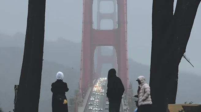
Much of the Sacramento Valley and the San Francisco Bay Area were under a flood watch and a high wind warning through Friday. Forecasters warned heavy snow and gusts were expected to create “near white-out conditions” Wednesday in parts of the Sierra Nevada and make it “nearly impossible” to travel through the mountain passes.
There's also a risk of severe thunderstorms and a small chance of tornadoes along the northern coast.
Heavy rain and flash flooding already led to water rescues and at least one death in Northern California, local officials said. Shasta County Sheriff Michael L. Johnson on Monday declared a state of emergency to prepare for more rain and allow the state to help with hazard mitigation and search and rescue operations.
Southern California typically gets half an inch to 1 inch (1.3 to 2.5 centimeters) of rain this time of year, but this week many areas could see between 4 and 8 inches (10 to 20 centimeters), National Weather Service meteorologist Mike Wofford said. It could be even more in the mountains. Gusts could reach 60 to 80 mph (96.5 to 127.8 kph) in parts of the central coast.
Officials expect multiple road closures and airport delays during the storms. Downed trees and power lines are also possible. Parts of Los Angeles are under evacuation warnings this week.
The county put up K-rails, a type of barrier, around the burn scar to help catch sliding debris during rainstorms. Residents could also pick up free sandbags to protect their homes, said Kathryn Barger, a Los Angeles County supervisor representing Altadena.
Many people in burn scar areas decided not to leave after receiving the evacuation notification, Los Angeles Police Department Chief Jim McDonnell said. He urged them to reconsider.
“The threat posed by this storm is real and imminent,” he said.
Local and state officials are gearing up to respond to emergencies through the week. The state has deployed resources and first responders to a number of counties along the coast and in Southern California. The California National Guard is also on standby to assist.
An atmospheric river is a long, narrow band of water vapor that forms over an ocean and flows through the sky, transporting moisture from the tropics to northern latitudes.
___
Associated Press writers Sophie Austin in Sacramento, California, and Jessica Hill in Las Vegas contributed to this report.