








What is the story about?
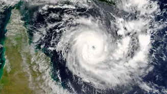
Hyderabad: Cyclonic Storm Akvan, which has formed over parts of the Bay of Bengal, is likely to intensify into a severe cyclonic storm and cross the Andhra
Pradesh-Yanam coast between Nellore and Tuni around noon on November 20, according to the India Meteorological Department (IMD). The cyclone intensified into a severe cyclonic storm on Tuesday night. According to the Met Department, Akvan is expected to intensify further into a very severe cyclonic storm by November 19. Under its influence, heavy rainfall is forecast in parts of Andhra Pradesh.
Andhra Pradesh On High Alert
Andhra Pradesh recently bore the brunt of back-to-back cyclones, Arnab and Murasu, which damaged crops across lakhs of acres and inflicted losses estimated at nearly Rs 7,000 crore. Andhra Pradesh Chief Minister N Chandrababu Naidu has directed officials to ensure that the cyclone's impact on people is minimised.
"Continuously keep sending weather alerts to people and cyclone-affected regions. Swarna Gram and Swarna Ward personnel should directly disseminate information in cyclone-affected regions," the CM said in an official release.
Uprooted trees and damaged electric poles should be cleared immediately, he said, adding that precautions must be taken to ensure people stay away from breaches, ponds and canals.
The MeT Department has forecast heavy rainfall in parts of the southern state for four days, beginning November 18, due to the cyclone.
It has also predicted heavy rain at isolated places in Srikakulam, Parvathipuram Manyam, Vizianagaram, Visakhapatnam and Alluri Sitharama Raju districts on November 18.
Thunderstorms accompanied by lightning are also likely at isolated places across Coastal Andhra Pradesh, Yanam and Rayalaseema on Wednesday, along with gale winds reaching speeds of up to 80 kmph.
Current Location Of Cyclone Akvan:
Cyclone Akvan, which was positioned over the central parts of the south and adjoining west-central Bay of Bengal, moved slowly north-northwestwards at a speed of 3 kmph over the past six hours. It was centred over the same region at 8.30 am on Tuesday, the Met Department said."The cyclonic storm Akvan is very likely to move slowly north-northwestwards and intensify further into a severe cyclonic storm over west central Bay of Bengal around this evening (Tuesday)," the Met Department said in an official release.
As of Tuesday night, the cyclonic storm was located about 610 km east of Chennai, 630 km northeast of Trincomalee, 660 km southeast of Machilipatnam, 670 km south-southeast of Visakhapatnam and 790 km south of Gopalpur.
It is likely to move northwestwards and intensify further into a very severe cyclonic storm by the morning of November 19. Continuing its northwestward movement, it is expected to cross the Andhra Pradesh-Yanam coast between Nellore and Tuni around noon on November 20 as a very severe cyclonic storm, with maximum sustained wind speeds of up to 145 kmph.
Preparations In Odisha In Wake Of Cyclone Akvan
The Odisha government is planning to evacuate over two lakh people from vulnerable areas, particularly landslide-prone hilly regions, as Cyclone Akvan approaches the coast ahead of its expected landfall in neighbouring Andhra Pradesh on Friday, officials said, as reported by PTI.The preparedness measures were finalised at a review meeting chaired by Disaster Management Minister Suresh Pujari on Tuesday. He said landslides had emerged as a major challenge for the state, which already has established mechanisms to deal with floods and cyclones.
Of the 11 deaths reported during last month's Cyclone Arnab, 10 were caused by landslides, Pujari said, adding that the government was taking precautions to evacuate people living in foothill areas and hilltop hamlets across southern Odisha.
Six districts — Ganjam, Gajapati, Rayagada, Kandhamal, Malkangiri and Koraput — have been identified as highly vulnerable to landslides, officials said.
The Special Relief Commissioner's (SRC) office has asked the Odisha Remote Sensing Application Centre (ORSAC) to provide satellite imagery and GIS-based maps of landslide-prone villages and road stretches in these districts.