


What is the story about?
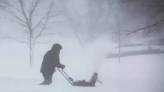
Early Sunday morning, people stepping outside in parts of the Florida Panhandle and Big Bend rubbed their eyes in disbelief. A light coating of snow, something
most locals associate with holiday movies rather than their own backyards, had quietly settled across the region. For the second winter in a row, a blast of Arctic air pushed far enough south to meet up with moisture from the Gulf of Mexico. The result: actual snowfall in a state that usually deals in sunshine and afternoon thunderstorms.
Where the Snow Fell and How Much
While Tallahassee saw only a few stray flakes that melted almost immediately thanks to mild ground temperatures, communities farther west got a better show. Areas around Pensacola, Destin, and Crestview reported steady snow falling through much of the morning.The National Weather Service confirmed measurable amounts in several spots, with some neighborhoods picking up as much as an inch. That might sound modest compared to last year's blockbuster event, the so-called "Big Snow" of January 2025 that dumped record totals up to 10 inches in places like Milton, but this year's surprise still stands out.
Meteorologist: Two Years in a Row Is Highly Unusual
Kristian Oliver, a meteorologist at the National Weather Service office in Tallahassee, described the back-to-back events as far from normal, as per a report from South Florida Reporter. "Seeing snow like this two winters running is really uncommon for our part of Florida," Oliver said. "Typically you might get one of these Arctic intrusions every few years, but the way it's lining up now feels pretty rare."This weekend's system is part of an enormous weather pattern stretching roughly 1,500 miles, from the Gulf Coast all the way up to Maine. Florida is sitting at the southern edge, so the totals are small by northern standards, but the fact that snow is falling here at all grabs attention.
Travel Trouble and the Danger Ahead
The wintry mix brought immediate headaches for drivers. Authorities put out alerts along Interstate 10, where a combination of sleet and snow left patches of black ice on bridges and overpasses. In Crestview and Milton, police responded to a handful of minor crashes as people who rarely see frozen roads found themselves sliding.Read more: Snow Storm Weather Hits the South: Could Florida Witness Snowfall This Weekend?
The National Weather Service stressed that the real risk might come after the snow stops. "The amount of snow isn't the biggest worry, it's what happens when things refreeze tonight," forecasters cautioned, as per the report. With temperatures expected to plunge into the low 20s Sunday night into Monday morning, any leftover moisture on roadways could quickly turn into solid ice, creating treacherous conditions for the morning commute.
Residents are being urged to take it slow, give extra space, and avoid unnecessary trips until the sun has a chance to warm things up again.