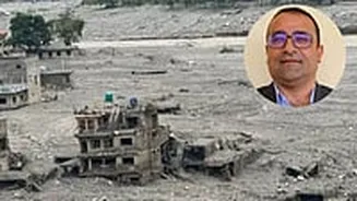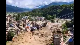





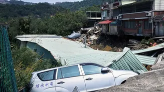
The catastrophic floods that tore through Nepal last week were triggered by a massive high-altitude glacier collapse, sending an avalanche of ice, rock, mud and water racing down mountain valleys and into
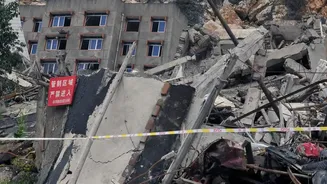
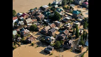
populated areas. The disaster devastated villages, roads, bridges and hydropower infrastructure, with the death toll in Nepal rising to at least 1,050 and nearly 4,000 people still unaccounted for a week later.
But even as rescue teams continue searching through tonnes of debris, the Himalayan terrain where the disaster began remains unstable.
Read More: Could More Lives Have Been Saved? Warning Signs Were Visible Before Nepal-China Disaster: Report
China’s Ministry of Water Resources has now warned that glaciers around the impact crater on Nepal’s Chhochen Khola River could still collapse, raising the possibility of another chain of landslides, river blockages and flooding. The warning comes even though one of the most immediate threats, water that had accumulated in the crater, has largely subsided.
According to China’s state broadcaster CCTV, cited by the Global Times, drone footage taken at 8 am on September 1 showed that the water accumulated in the impact crater had “largely drained”, with the downstream river flowing normally. But the ministry said the surrounding glaciers remain vulnerable to further collapse and pose a “major potential hazard”.
This means that while the water threat may have eased, the geological threat has not disappeared.
How The First Disaster Unfolded
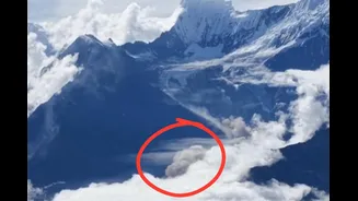
On August 26, part of a glacier near Nepal’s Langtang Lirung area, at an altitude of roughly 5,200 metres, broke away. The collapse sent an enormous mass of ice and rock into the valley below, triggering a high-speed debris flow.
The material travelled for more than 20 kilometres and, according to geological assessments cited by Reuters, moved at around 50 metres per second. As it descended through the steep, narrow Himalayan terrain, it gathered more rock, soil and water, increasing the destructive force of the flow.
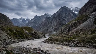
The resulting torrent swept through the Lhende Khola and connected river systems, devastating areas in Nepal and reaching Tibet’s Gyirong Port across the border.
The impact was enormous. Floodwaters altered river channels more than 100 kilometres downstream, falling more than 4,500 metres in elevation from the high Himalayan source towards lower parts of Nepal.
The disaster has left at least 1,050 people dead in Nepal, while around 3,900 remain unaccounted for, according to the latest figures. Another 16 people have died and 546 remain missing on the Tibet side.
Why Another Disaster Remains Possible
The initial glacier collapse did more than send a destructive wave downstream. It also radically altered the landscape.
Huge quantities of ice, rock and mud were deposited in river channels. In places, this material acted like a natural dam, trapping water and creating temporary barrier lakes.
Such lakes are dangerous because their dams are made from unstable debris rather than engineered structures. If the natural barrier collapses, water can be released suddenly, creating another destructive flood wave.
In the latest assessment, China’s Ministry of Water Resources said satellite imagery showed that the 14 glacial lakes previously identified in the Gyirong Tsangpo River basin remained broadly stable. That is reassuring in one sense, but it does not eliminate the wider danger.
The ministry’s concern is now focused particularly on the glaciers and unstable slopes around the Chhochen Khola impact crater.
There is another complication. China’s monitoring has detected small landslides along riverbanks downstream of the existing barrier lake. Such landslides can dump enough material into a river to obstruct its flow and create a fresh barrier lake. China’s Ministry of Water Resources has therefore been conducting continuing assessments of the “full-chain risks” associated with the disaster.
In other words, one collapse can trigger another.
Why A Second Collapse Could Be Dangerous
The danger comes from the way Himalayan disasters can cascade. A glacier collapse can trigger an ice-rock avalanche. That avalanche can cause a debris flow. The debris can block a river. The blockage can create a temporary lake. If the lake breaches, or another landslide suddenly blocks and then releases the river, a new flood can race downstream.
And because Himalayan valleys are steep and narrow, water and debris can move extremely quickly.
The first disaster demonstrated exactly how far-reaching such an event can be. Reports said that water levels downstream at Galchhi rose by as much as nine metres within 30 minutes after the August 26 event.
That leaves little time for communities to react if another major collapse occurs.
Why The Himalayas Are Particularly Vulnerable
The latest warning also comes amid growing concern over the stability of glaciers and mountain slopes as temperatures rise.
Scientists have cautioned that climate change should not automatically be treated as the sole trigger for the August collapse. However, warming temperatures and glacier melt can weaken frozen terrain and contribute to instability. Reuters quoted Simon Cox, chief scientist at Earth Sciences New Zealand, as saying that climate change is creating conditions capable of destabilising high-mountain rock and ice, potentially making collapses and cascading hazards more frequent.
For Nepal, this is a particularly serious problem. The country depends heavily on its mountain rivers for drinking water, agriculture and hydropower, while settlements and critical infrastructure are often concentrated along narrow river valleys.
The latest Chinese monitoring offers some immediate reassurance: the water in the Chhochen Khola impact crater has largely drained and the downstream river is currently flowing normally. But authorities are continuing to watch the surrounding glaciers, slopes and river channels precisely because the end of one flood does not necessarily mean the end of the hazard.
For a country still digging through the wreckage of one of its worst disasters, the threat of another collapse means rescue and recovery efforts must proceed alongside constant monitoring of the mountains above them.