


The Narendra Modi government has begun work on one of its most strategic infrastructure projects—an airport at India’s southernmost tip on Great Nicobar Island. According to documents accessed by CNN-NEWS18,
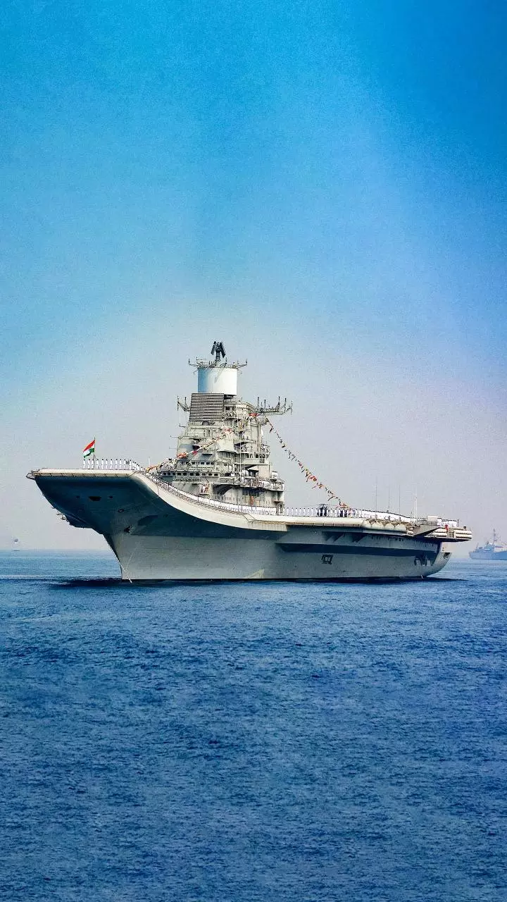
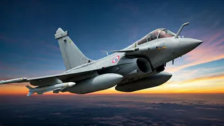
the airport is expected to significantly boost India’s defence capabilities, allow operations of larger military aircraft and sharply reduce response times for defence platforms. The project is also being positioned as vital for national security and tourism.
CNN-NEWS18 has accessed the exclusive blueprint of the proposed dual-use military airfield, which will be developed as part of the airport project. The government has initiated the process by inviting consultants for the strategic development.
Located at the southernmost edge of Indian territory on Great Nicobar Island, close to the strategically vital Six Degree Channel, the Great Nicobar International Airport is envisioned as a transformative national asset. It aims to strengthen India’s security posture while unlocking long-term economic and connectivity potential in the Indian Ocean Region.
Its location near one of the world’s busiest international maritime trade routes gives it exceptional strategic relevance, particularly as the nearest major civilian airport—Veer Savarkar International Airport in Port Blair—is over 500 kilometres away. Once operational, response times for defence aircraft operating in the region are expected to be significantly reduced.

According to documents seen by CNN-NEWS18, the airport will enable operations by larger military platforms, substantially extending India’s operational reach across the eastern Indian Ocean.
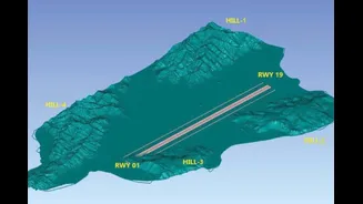
The airport site is surrounded by hills on four sides. Two hills near the eastern side of the runway strip will be cut to the required height to mitigate interference with Obstacle Limiting Surfaces (OLS). Great Nicobar Island is sparsely populated and largely covered by dense rainforest.
Conceived as a dual-use facility, the airport is designed to function as a strategic military airfield alongside a modern civil airport. Control of airside operations and air traffic services will rest with the Indian Navy, while passenger terminals, civil aprons and associated facilities will be managed by the Airports Authority of India.
Civil flight operations will follow the established framework used at existing joint-use naval air stations. A detailed operational agreement defining civilian movement parameters will be finalised before operations begin.

Beyond its defence role, the airport is expected to become the principal air gateway for Great Nicobar and surrounding islands, addressing decades of geographical isolation.
The airport’s location offers an international advantage, with popular island destinations such as Phuket and Langkawi within 500 kilometres, while the Indian mainland lies over 1,500 kilometres away. This proximity positions Great Nicobar as a potential hub for high-end tourism, integrating the Andaman and Nicobar Islands into global travel circuits while supporting sustainable local livelihoods.
Great Nicobar Island, the largest and southernmost of the Nicobar group, stretches from Ranganatha Bay on the east coast to Galathea Bay in the south, curving around Indira Point — India’s southernmost land point. Indonesia’s Sumatra lies just 180 kilometres to the south.
Spanning around 910 square kilometres, most of the island falls within the Great Nicobar Biosphere Reserve and is home to indigenous Shompen and Nicobarese communities.
The proposed airport site lies along the southern coastline between Gandhi Nagar and Shastri Nagar and is connected by road to Campbell Bay, about 30 kilometres away. Surrounded by hills and dense rainforest, the site has been planned to ensure aviation safety while minimising environmental disturbance, with flight paths aligned over the sea to avoid low-altitude overflying of inhabited areas.
As a greenfield project, traffic forecasts are based on projected urban and economic development rather than historical data. The island’s population is projected to rise sharply, with estimates indicating around 3.25 lakh residents by 2040, translating into an annual passenger potential of approximately 1.35 million.
In the initial phase, traffic is expected to be entirely domestic, with international passenger volumes growing gradually as tourism infrastructure develops. The master plan follows a 50-year horizon up to 2075, with phased development linked to demand, ensuring capacity expansion occurs only when utilisation reaches optimal levels.
Military air traffic projections have been factored in separately, reflecting the airport’s strategic role from the early 2030s. The airfield layout allows for future widening of runways and taxiways to accommodate larger aircraft, while initial operations will begin with configurations suitable for medium-category platforms.
Engineering design has taken into account the island’s challenging topography and ecological sensitivity. Selective hill cutting has been proposed only where necessary to meet obstacle limitation requirements, with excavated material reused within the airport boundary and other island infrastructure projects to avoid external dumping in forested areas.
Runway and terminal elevations have been optimised for safety, drainage and resilience, with soil stabilisation measures and full compliance with DGCA and ICAO standards.
The passenger terminal is planned as a modern, integrated facility designed to be carbon-neutral in operations and compliant with GRIHA-5 sustainability standards. It will incorporate renewable energy systems and continuous power monitoring, while architectural elements and interiors will reflect local art and culture.
Adequate space has been earmarked for commercial activity to ensure long-term financial viability without compromising passenger comfort or movement.
The Great Nicobar International Airport is envisioned not merely as a transport facility but as a strategic gateway that reinforces India’s maritime security, catalyses economic opportunity and connects the country’s southernmost frontier to the rest of India and the world.