


Just ten days ago, Delhi was witnessing the hottest March week in 50 years with temperatures soaring above 35 degrees Celsius. Days after, within the same month, Delhiites have been waking up to rains
for two consecutive days, and the same March now has become the wettest March for the city in three years. Delhi has recorded approximately 9.4 mm of rainfall at the Safdarjung observatory from March 1 to March 19, 2026, making it the wettest March in three years. Recent rains on March 18-19 added 8.2 mm on one day, pushing totals near the monthly normal of 12.6 mm.
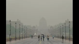
The Indian Meteorological Department (IMD) has issued rain and thunderstorm alerts for Delhi-NCR and much of North India for Friday, March 20, putting a yellow alert in place. The rain spell is expected to continue on Saturday, March 21, with light to moderate showers and possible thunderstorms through the day. Overcast conditions will keep temperatures well below recent highs. The intensity of rains may lower on Sunday, March 22, even though there may be isolated showers in some parts, which means the temperatures are going to remain lower over the weekend.
The Sudden Shift in March Temperatures: What’s Really Happening?
The sudden change in weather in Delhi-NCR has become a topic of discussion on social media. It’s not just a centre of memes but mny are asking what’s really happening and whether this is normal.
March is usually called the transition month when two weather systems are in the exit and entry phases. Hence, the temperature change isn’t unusual climate whiplash so much as two different weather systems taking turns over North India — one causing extreme heat, the other bringing rain.
Pre-Summer Heat
In early March over northwest India, including Delhi, the weather was dominated by clear skies, very dry air, and strong sunlight, which together created ideal conditions for rapid heating of the land surface. Under these conditions, winds blowing from the interior of the continent — often referred to as continental dry winds — brought hot, moisture-free air over the plains. Because there were few or no clouds, nothing blocked the sun’s energy from reaching the ground during the day; this meant that the surface could warm up very quickly, and the heat was then transferred into the air just above it.
Without moisture in the air to absorb and redistribute heat, temperatures soared, pushing maximum past 35 °C — unusually high for March in the region. This kind of intense warming is characteristic of the pre-summer heating phase that typically occurs before the larger atmospheric systems (like Western Disturbances or monsoon currents) start influencing the weather, and it’s why Delhi experienced one of its warmest March weeks in decades during that period.
Western Disturbances
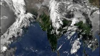
Western Disturbances are large storm systems that form far to the west of India, usually around the Mediterranean region, and then travel eastwards across West Asia towards the Indian subcontinent. As they move, they gather moisture and develop broad cloud bands high in the atmosphere. By the time they approach North India, they are loaded with humid air and unstable weather conditions. These systems are steered by fast-moving winds in the upper atmosphere, which is why they can cover long distances and influence weather far from where they originated.
The change in temperature came when a Western Disturbance — a travelling storm system that forms far to the west and moves towards India — reached the northern plains. It carried moisture and thick cloud bands that blocked sunlight and triggered showers and thunderstorms. Rain-cooled air and overcast skies quickly pulled temperatures down, making the shift feel sudden and dramatic.
Delhi’s March 2026 rain at 9.4 mm exceeds March 2024 and 2025 but trails 2023’s 50.4 mm. The normal March average is 12.6 mm.
Climate Change: The Big Picture
Scientists and meteorologists say that as the climate warms due to increased greenhouse gases in the atmosphere, the basic patterns of temperature and rainfall are changing in ways that can make weather more extreme and less predictable. Dr Mrutyunjay Mohapatra, Director-General of Meteorology at the India Meteorological Department, has noted that global temperatures have risen by about 1.2 °C compared to a century ago, and this warming has an impact on extreme weather events, making the atmosphere able to hold more moisture and potentially produce heavier rainfall. In India, this means heatwaves can become more intense and frequent, and rain events — whether winter disturbances or monsoon bursts — can deliver heavier bursts in shorter periods as the atmosphere’s moisture-holding capacity increases.
At the same time, recent research on Western Disturbances suggests that warming trends can alter their behaviour, pushing more moisture upwards and affecting when and how they bring rain to the plains. Scientists have pointed out that rising heat stress in the atmosphere changes the dynamics of these disturbances, leading to increased chances of erratic precipitation outside the usual winter season and more intense weather variations overall. This doesn’t necessarily mean every year will be hotter or wetter everywhere, but the general trend is toward more variability — stronger heat bursts followed by concentrated rain spells — compared to the steadier patterns of the past.