





Wednesday’s devastation along the Nepal-Tibet border is the latest reminder that in Nepal, earthquakes, landslides, avalanches, floods and glacier-related disasters do not exist in isolation. One hazard
can trigger another, turning a relatively local event into a rapidly moving catastrophe.
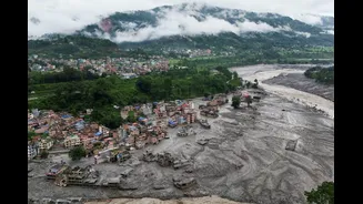
On Wednesday, a massive flash flood tore through Nepal’s Rasuwa district along the Bhotekoshi-Lhende Khola system, destroying homes, roads, bridges and critical infrastructure. The death toll has since climbed sharply over 160, while hundreds remain missing. Initial reports suggested an earthquake may have triggered an avalanche, but subsequent satellite and geological assessments have increasingly pointed to a glacial/ice collapse and debris cascade rather than a tectonic earthquake as the trigger.
The bigger question is: Why does Nepal repeatedly find itself at the centre of such disasters?
ALSO READ | Nepal Flood: Water Level Drops In Gandak River; Bihar, UP Out Of Immediate Danger?
The answer lies in a dangerous combination of two colliding tectonic plates, extreme mountain topography, a warming cryosphere, intense monsoon rainfall, unstable slopes and infrastructure concentrated in narrow valleys.
1. The Tectonic Trap
The Himalayas exist because the Indian and Eurasian tectonic plates are still pushing into each other.
The Indian plate is converging with the Eurasian plate at roughly 20-21 mm a year. That collision began around 50 million years ago and continues today, constantly deforming and stressing the Earth’s crust beneath the Himalayas.
That makes Nepal highly earthquake-prone.
The 2015 Gorkha earthquake, for example, killed nearly 9,000 people and demonstrated how an earthquake in the mountains can produce a chain reaction, where ground shaking leads to landslides, blocked rivers, collapse of infrastructure, and isolation of communities.
And earthquakes do not have to be the final disaster.
ALSO READ | Nepal Flash Floods Renew Fears Over China’s Monster Dam On Brahmaputra. Is It A ‘Water Bomb’ Near India?
A strong tremor can destabilise glaciers, rock faces and already-fragile slopes. That can trigger avalanches and landslides, which can then block a river and create a temporary natural dam. When that dam breaks, a wall of water and debris can rush downstream.
That is why the Himalayas can produce what looks like a single disaster but is actually a cascade of hazards.
2. Weaponising Water
Nepal has some of the world’s highest mountains, but its rivers often run through very narrow and steep valleys. This is crucial during floods.
When enormous quantities of water suddenly enter a narrow Himalayan gorge, there is little room for the flow to spread out. Instead, gravity accelerates it downhill.
The Indian Express explains that Nepal’s high peaks and narrow, deep river gorges effectively create natural funnels, increasing the speed and destructive power of floodwaters.
A Himalayan flash flood can pick up rocks, boulders, trees, soil, ice, and construction debris. The result is closer to a moving wall of water, mud and rock than the slow-rising floods seen on plains. That leaves people living downstream with very little time to react.
3. Himalayas Are Warming
This is where climate change worsens Nepal’s traditional geological vulnerability.
The Hindu Kush Himalaya is warming rapidly, causing glaciers to lose mass and retreat. The latest 2026 assessment by the International Centre for Integrated Mountain Development (ICIMOD) says glacier wastage across the Hindu Kush Himalaya has doubled since 2000. It also warns that monitoring remains inadequate: only a small number of glaciers have long-term observations meeting international standards.
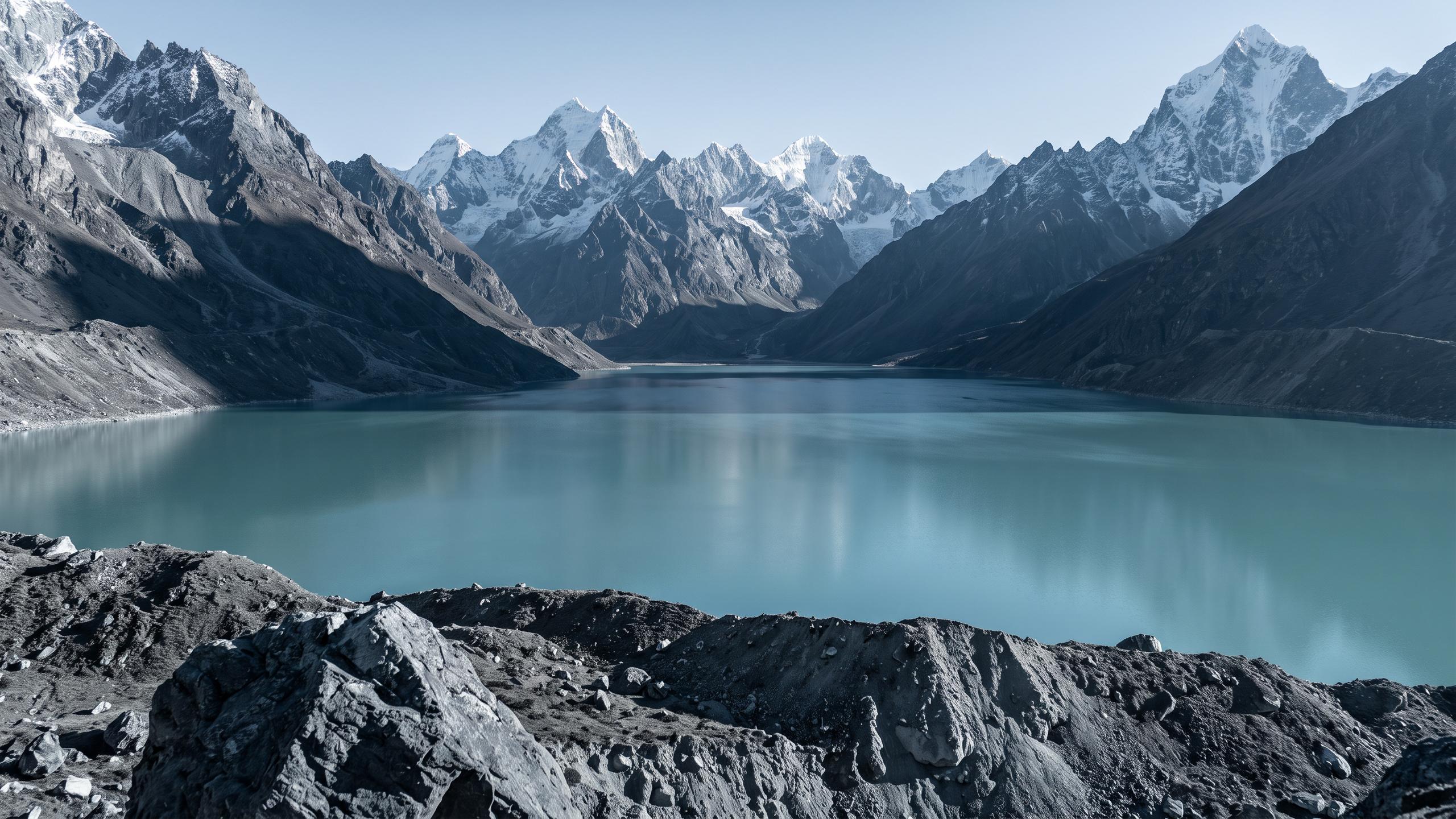
This matters because melting ice can mean more unstable water storage high in the mountains. As glaciers retreat, meltwater can accumulate in lakes held back by unstable moraines—ridges of rock and sediment left behind by glaciers. These are known as glacial lakes.
ALSO READ | Nepal Flood Horror: Why Experts Fear A Second ‘Wall Of Water’ Could Be Coming
If the natural barrier fails, the lake can suddenly empty in a Glacial Lake Outburst Flood, or GLOF. That can send a huge volume of water and debris downstream in minutes.
4. The Land Of Glacial Lakes
The scale of the problem is significant.
An inventory by the UN Development Programme in 2020 identified 3,624 glacial lakes across the Koshi, Gandaki and Karnali basins, with 47 classified as potentially dangerous—25 in Tibet, 21 in Nepal and one in India.
But there is an important problem with simply counting these lakes. The risk map itself can change.
New supraglacial lakes can appear on melting glaciers, expand over several seasons and disappear suddenly. That means a lake that was not considered dangerous, or was not even present, can become a hazard relatively quickly.
The July 2025 disaster in the same broad Rasuwa-Bhotekoshi region illustrated this danger. A glacial lake in Tibet was linked to a major flood that killed people and damaged bridges and hydropower infrastructure. And now, just 14 months later, the same river system has been hit again.
5. A Devastating Chain
This is perhaps the most important thing to understand about Nepal.
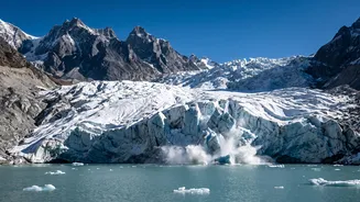
The August 26 disaster was not simply “flood”. What started off with glacier/ice instability led to ice-rock collapse or an avalanche. This leads to massive debris entering the river, thereby blocking it. Water builds up behind the blockage, leads to the failure of the natural dam, and ultimately triggers a flash flood and a debris surge downstream.
Climate experts said an ice-rock avalanche from a glacier likely caused the latest flood, while other early accounts had suggested an earthquake-induced landslide. Subsequent US Geological Survey analysis pointed to a glacial collapse rather than an earthquake as the cause.
That distinction matters, but the broader vulnerability remains the same.
A warming, unstable mountain environment provides the material, steep terrain provides the speed, rivers provide the pathway, and ultimately, people downstream bear the impact.
6. Monsoon Mayhem
Nepal also sits directly in the path of the South Asian monsoon. Heavy rainfall saturates mountain slopes, increasing the likelihood of slope failure, landslide, river blockage, and flash flood.
The World Bank has repeatedly highlighted Nepal’s exposure to floods and landslides and the way its difficult terrain amplifies climate-related risks.
To add to it, climate change is complicating the monsoon itself. ICIMOD warned in 2026 that the Hindu Kush Himalaya was facing an increasingly erratic monsoon and rising temperatures, conditions that can heighten flash-flood risks.
7. Landslides Built Into Nepal’s Geography
The Himalayas are young, steep and geologically active. That means slopes are naturally unstable. Add to it intense rainfall, earthquakes, road construction, deforestation and land-use changes, erosion, and glacier retreat, and the likelihood of slope failures increases.
A landslide can itself become a disaster multiplier. It can bury a road, cut electricity, destroy homes or dam a river. If the river later breaks through the landslide barrier, the resulting flood can be even more destructive. This is why a mountain disaster can spread far beyond the location where it begins.
8. Narrow Valleys Add To Problems
Nepal’s geography creates another problem—there simply aren’t many flat places to build.
Settlements, roads, bridges, hydropower projects and other infrastructure are frequently concentrated along valleys and river corridors. Those are precisely the routes through which floodwaters and landslides travel.
According to The Indian Express, the narrow nature of habitable valleys can concentrate communities, meaning a single disaster can simultaneously isolate large numbers of people and cut their access to emergency assistance.
The latest floods demonstrated this vividly, destroying roads, bridges, communications infrastructure and hydropower facilities. The damage is therefore not just about lives and homes. A single event can sever the infrastructure needed to rescue survivors.
9. Harder Rescue Operations
Even after the disaster has happened, Nepal’s geography makes recovery difficult. A landslide can block the only road into a settlement. A destroyed bridge can cut off an entire valley. Heavy sediment can prevent vehicles from reaching affected areas.
Helicopters may be the only option in some locations, but bad weather, steep terrain and the lack of suitable landing areas complicate aerial rescue. Several media outlets reported how rescue helicopters could not immediately land in some affected areas because of the conditions created by the flooding.
So, the same geography that makes the initial disaster more destructive also makes the response slower and more difficult.
10. A Man-Made Disaster?
Calling Nepal simply a country prone to “natural disasters” misses an important part of the story.
The World Bank has noted that buildings in Nepal can be particularly vulnerable to earthquakes, floods and landslides because of poor construction practices and inadequate infrastructure standards. Rapid urbanisation can further increase exposure.
Nepal, thus, remains vulnerable not because it experiences one unusually dangerous natural hazard, but because several hazards overlap in the same place.