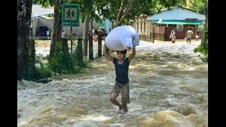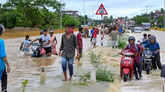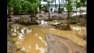






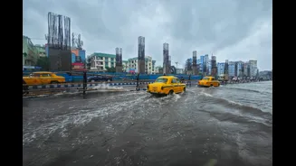
Assam is once again battling one of its worst flood disasters in recent years. The latest spell of torrential rain has pushed the death toll to 50, with nearly eight lakh people affected across 16 districts.
Rescue teams from the National Disaster Response Force (NDRF), State Disaster Response Force (SDRF), Army and Air Force remain deployed as swollen rivers continue to inundate villages, roads and agricultural land. Authorities have also warned that the situation could worsen as more heavy rainfall has been forecast.
Read More: Assam Flood Death Toll Rises To 50: Heavy Rain Forecast Keeps Situation Grim
For Assam, however, floods are not an exception – they are an annual reality. Every monsoon, the state braces for overflowing rivers, mass displacement, damaged crops and loss of life. Despite decades of embankment construction, river management projects and disaster preparedness, the cycle continues.
The Brahmaputra: A River Unlike Any Other
At the heart of Assam’s flood problem lies the Brahmaputra, one of the world’s largest and most dynamic river systems.
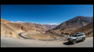
Originating in Tibet as the Yarlung Tsangpo, the river enters Arunachal Pradesh as the Siang before flowing through Assam and eventually into Bangladesh. Along its journey, it is fed by more than 50 major tributaries, including the Subansiri, Manas, Jia Bharali, Dhansiri and Kopili.
Unlike most Indian rivers, the Brahmaputra carries one of the highest sediment loads in the world. Massive quantities of sand, silt and rocks washed down from the young Himalayas constantly alter its course, making the river shallow in many stretches and reducing its capacity to carry floodwaters. During the monsoon, intense rainfall over Arunachal Pradesh, Bhutan and the eastern Himalayas causes water levels to rise rapidly, leaving downstream districts in Assam vulnerable to sudden flooding.
Why Floods Have Become More Severe
Flooding in Assam is a natural phenomenon, but several factors have made it increasingly destructive.
Climate scientists point to more frequent extreme rainfall events across the eastern Himalayas and Northeast India. Heavy downpours occurring over short periods overwhelm rivers and drainage systems, leading to flash floods.
At the same time, rampant erosion has become an equally serious threat. Every year, the Brahmaputra eats away thousands of hectares of fertile land, forcing families to abandon homes and villages permanently. Many displaced residents eventually settle on vulnerable river islands, locally known as ‘chars’, where they remain exposed to the next flood cycle.
Human interventions have also compounded the problem. Encroachment of wetlands, deforestation in upstream catchments and ageing embankments have reduced the landscape’s natural ability to absorb excess water. Experts have repeatedly argued that embankments alone cannot provide a permanent solution, particularly when the river itself keeps changing course.
Assam’s Deadliest Flood Years
The state has witnessed several devastating floods over the past few decades.
The 1988 floods remain among the deadliest in Assam’s recorded history, claiming more than 500 lives while affecting millions of people across the state. Subsequent decades have seen repeated large-scale disasters.
In 1998, floods killed over 100 people and submerged vast areas of the state.
The 2004 floods affected nearly 16 million people across multiple waves, making it one of the largest humanitarian crises in Assam’s history.
The 2012 floods claimed more than 120 lives and inundated large parts of Kaziranga National Park, leading to the deaths of hundreds of wild animals.
In 2019, around 5.2 million people were affected and 59 people lost their lives as the Brahmaputra overflowed across 30 districts.
The 2022 floods were among the worst in recent memory. Spread across multiple waves over several months, the disaster affected around 5.6 million people in 32 districts and claimed more than 190 lives, while Silchar witnessed one of its worst urban flooding episodes after the Barak river breached embankments.
Now, in 2026, Assam is once again staring at a major humanitarian crisis, with the current death toll already touching 50 and officials warning that the final toll could be much higher as search operations continue.
Can There Be A Permanent Solution?
Experts say no single engineering intervention can eliminate floods in Assam. Instead, they advocate a combination of scientific river basin management, stronger embankments where necessary, restoration of wetlands, better floodplain zoning, improved forecasting and community-based early warning systems.
Many also argue that the focus must shift from merely controlling floods to learning how to live with them. For Assam, where the Brahmaputra has shaped both its geography and culture for centuries, annual flooding may be inevitable. Turning these floods from recurring disasters into manageable natural events remains the state’s biggest challenge.
Why China’s Brahmaputra Project Is A Concern
India has repeatedly raised concerns over China’s proposed mega hydropower project on the Yarlung Tsangpo, the upper reaches of the Brahmaputra, citing potential downstream implications for water security, ecological balance and disaster management. While Beijing has maintained that the project is a run-of-the-river hydropower scheme that will not significantly alter the river’s natural flow, New Delhi has stressed the need for transparency and timely sharing of hydrological data.
Indian officials have also flagged concerns over the possibility of sudden water releases during extreme weather events, which could complicate flood forecasting and disaster response in downstream states such as Arunachal Pradesh and Assam.
Another key concern is the impact on sediment flow, as the Brahmaputra’s enormous sediment load plays a vital role in sustaining Assam’s fertile floodplains and maintaining the river’s natural morphology. India has consistently maintained that the interests of downstream communities must be protected and has called for greater cooperation and information-sharing on projects being undertaken upstream on transboundary rivers.