


What is the story about?
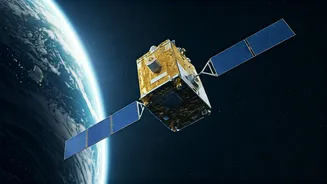
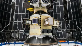
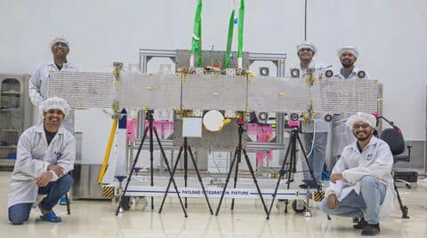
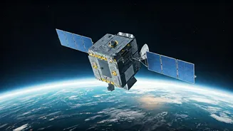
Bengaluru-based space startup GalaxEye has successfully launched its first commercial satellite, Drishti, into orbit aboard SpaceX’s Falcon 9 rocket, marking a significant milestone for India’s private space sector.
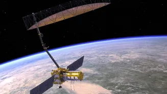
Described as the world’s first “OptoSAR” satellite, the 190 kg spacecraft integrates electro-optical and synthetic aperture radar (SAR) sensors on a single platform, enabling round-the-clock, all-weather imaging. The company said the mission represents a major leap in Earth observation technology and reflects India’s growing capabilities in the global space ecosystem.
Speaking to NDTV ahead of the launch, GalaxEye founder and CEO Suyash Singh termed the mission a technological breakthrough, underscoring the need for India to rethink satellite design.
“This mission is called Drishti — it stands for the ability to see through anything and everything,” he told NDTV. “What makes it unique is the integration of a multispectral camera and a synthetic aperture radar (SAR) imager on a single platform. This is a first-of-its-kind system.”
Singh said such capabilities could allow India to independently access high-quality imagery for damage assessment during operations like Operation Sindoor, reducing reliance on foreign commercial satellites. He also pointed to the ongoing Israel-US-Iran conflict as an example of why sovereign space-based observation systems are critical, especially in light of restrictions on sharing satellite imagery.
All-weather imaging capability
Drishti’s hybrid system can see through clouds, darkness and adverse weather while delivering high-resolution optical images. By combining both data streams, it is designed to provide more consistent and actionable intelligence.
Wide range of applications
The satellite is expected to support sectors such as border surveillance, disaster response, agriculture, infrastructure planning and insurance. Its radar capability ensures uninterrupted imaging even during floods, cyclones or heavy cloud cover.
AI-powered data processing
A key feature onboard is an artificial intelligence system powered by Nvidia’s Jetson Orin platform. This enables in-orbit processing, reducing the need to transmit large volumes of raw data back to Earth and accelerating the delivery of usable insights.
GalaxEye said Drishti can deliver imagery at a resolution of 1.5 metres and revisit locations globally every seven to ten days. The satellite, roughly the size of a compact refrigerator, is equipped with a deployable antenna spanning about three-and-a-half metres.
The company previously validated its technology through nearly 500 aerial missions using drones, Cessna aircraft and high-altitude platforms. It also flew an earlier payload on an ISRO PSLV mission under the POEM platform.
Growing interest from agencies
The project has already drawn interest from both defence and civilian sectors. GalaxEye said it has held discussions with multiple government departments, while agencies such as the Defence Space Agency, Indian Air Force, Army and Navy have been closely tracking its progress.