


What is the story about?
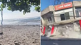
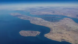
A powerful offshore earthquake measuring 7.8 on the Richter scale struck off the coast of Mindanao in the southern Philippines on Monday, killing at least 32 people, injuring more than 200 others and triggering a tsunami that sent waves of up to one metre onto nearby coastlines.
According to the Associated Press, the latest casualty figures include 17 people who died in an earthquake-triggered landslide, taking the overall death toll to 32.
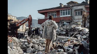
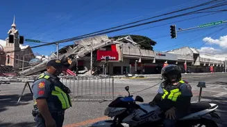
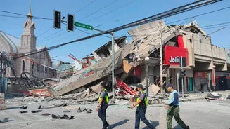
The quake caused significant damage in parts of southern Philippines, with several buildings damaged and key infrastructure affected in General Santos City. Tsunami-related damage was also reported in at least one coastal village. Smaller tsunami waves were recorded in Indonesia, Palau and as far away as southern Japan.
The German Research Centre for Geosciences (GFZ) said the earthquake struck at a depth of 10 kilometres. Initial estimates varied among monitoring agencies, with GFZ earlier placing the quake at magnitude 8.2 before revising it to 7.8. Indonesia's BMKG measured it at 7.7, while the Philippine Institute of Volcanology and Seismology (Phivolcs) reported a magnitude of 7.0.
Following the quake, authorities in the Philippines and neighbouring Indonesia issued tsunami warnings. The US Tsunami Warning System also issued a tsunami threat alert for the region. Phivolcs warned that tsunami waves exceeding one metre could impact coastal areas and continue for several hours.
In Alabel town in Sarangani province, police chief Benjie Ancheta said the local police station sustained cracks during the earthquake, which struck while officers were attending a flag-raising ceremony.
"There were no immediate reports of casualties, but some people fainted because of the strong shaking. This is the strongest earthquake we've experienced," Ancheta told Reuters.
Witnesses in Indonesia's northern city of Manado also reported strong tremors.
The Philippines and Indonesia lie along the seismically active Pacific Ring of Fire, a region prone to frequent earthquakes and volcanic activity due to the interaction of several tectonic plates.
With inputs from AP and Reuters.
According to the Associated Press, the latest casualty figures include 17 people who died in an earthquake-triggered landslide, taking the overall death toll to 32.
The quake caused significant damage in parts of southern Philippines, with several buildings damaged and key infrastructure affected in General Santos City. Tsunami-related damage was also reported in at least one coastal village. Smaller tsunami waves were recorded in Indonesia, Palau and as far away as southern Japan.
The German Research Centre for Geosciences (GFZ) said the earthquake struck at a depth of 10 kilometres. Initial estimates varied among monitoring agencies, with GFZ earlier placing the quake at magnitude 8.2 before revising it to 7.8. Indonesia's BMKG measured it at 7.7, while the Philippine Institute of Volcanology and Seismology (Phivolcs) reported a magnitude of 7.0.
Following the quake, authorities in the Philippines and neighbouring Indonesia issued tsunami warnings. The US Tsunami Warning System also issued a tsunami threat alert for the region. Phivolcs warned that tsunami waves exceeding one metre could impact coastal areas and continue for several hours.
In Alabel town in Sarangani province, police chief Benjie Ancheta said the local police station sustained cracks during the earthquake, which struck while officers were attending a flag-raising ceremony.
"There were no immediate reports of casualties, but some people fainted because of the strong shaking. This is the strongest earthquake we've experienced," Ancheta told Reuters.
Witnesses in Indonesia's northern city of Manado also reported strong tremors.
The Philippines and Indonesia lie along the seismically active Pacific Ring of Fire, a region prone to frequent earthquakes and volcanic activity due to the interaction of several tectonic plates.
With inputs from AP and Reuters.