


Maharashtra's Deluge Explained
While Mumbai has been enjoying a dry spell, much of Maharashtra has been pounded by significant pre-monsoon weather events. On a recent Thursday night,
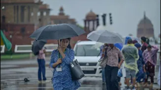
areas across the state witnessed severe thunderstorms accompanied by hail, a stark contrast to the city's relatively calm conditions. Pune, for instance, recorded its wettest April day since 1896, a testament to the intensity of these unusual showers. Parts of Marathwada and Vidarbha also endured continuous rainfall over a period of three to four days, impacting daily life and agricultural activities. This widespread and intense precipitation highlights a significant deviation from typical pre-monsoon patterns, leaving residents in affected regions grappling with unexpected weather disruptions.
Mumbai's Weather Anomaly
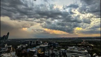
The India Meteorological Department (IMD) has indicated that Mumbai and its surrounding regions are unlikely to experience substantial rainfall until the latter half of May. Despite a forecast for thunderstorms, only scattered, light showers were observed in some suburban areas of Mumbai on a recent Thursday night. This localized and minimal rainfall stands in sharp contrast to the severe weather battering other parts of Maharashtra. Scientists from the IMD attribute this difference to Mumbai's geographical positioning relative to a meteorological phenomenon known as a 'line of discontinuity,' which is currently influencing weather patterns across the state but bypassing the city.
The Science Behind the Divide
Meteorologists explain that the current weather scenario is driven by a Western Disturbance (WD) system, which is bringing westerly winds into the region. A 'line of discontinuity' is an atmospheric boundary where there's a significant shift in wind direction or speed, creating unstable conditions conducive to thunderstorms. Sushma Nair, a scientist at IMD Mumbai, elaborated that in areas like Madhya Maharashtra and Marathwada, these westerly winds are interacting with easterly winds along this discontinuity. This interaction is fueling the thundershowers and rain activity observed in those regions. Mumbai, however, lies outside the direct influence of this specific line of discontinuity. The limited moisture reaching Mumbai was primarily due to the influence of the WD system, resulting in only light rain potential, not the heavy downpours seen elsewhere.
Forecasting for Mumbai
Looking ahead, the IMD's forecast for the Mumbai Metropolitan Region has explicitly excluded the likelihood of significant rain in the coming days. Experts predict that heavy showers are not expected to impact the Mumbai region until late May. While thunderstorms are a common occurrence during the summer months, substantial rainfall in April is considered a rare event for the city. Historical data from the weather bureau shows that Mumbai's wettest April on record was in 2023, with a total rainfall of just 14 mm. As Mumbai continues to evade these heavy showers, the IMD anticipates normal temperature ranges for the city over the next week, with maximum temperatures expected to hover between 32-33°C and nighttime temperatures around 23°C.