






What's Happening?
Donovan-Hill Group, Inc. (DHG) is actively seeking an experienced and motivated Survey CAD Technician to join its Geomatics team in Pensacola, Florida. This position is crucial for transforming field-collected survey data into accurate mapping and design
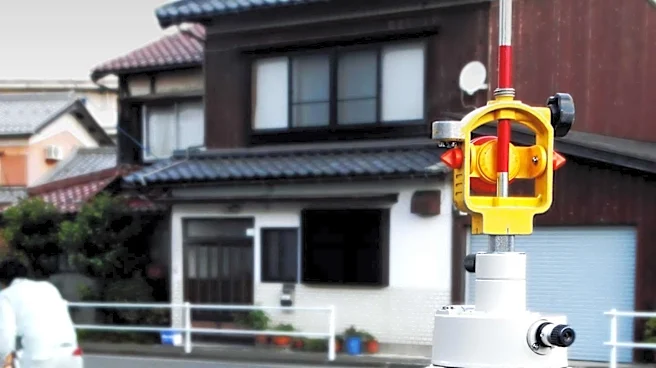
deliverables using AutoCAD Civil 3D and other geospatial software. The technician will collaborate closely with Professional Surveyors, project managers, field crews, UAV pilots, and LiDAR specialists. DHG emphasizes innovation, investing in advanced surveying technologies such as UAV mapping, terrestrial laser scanning, GNSS, and hydrographic surveying. The company is committed to professional development, offering opportunities for technical training, cross-discipline collaboration, and long-term career advancement within a team-oriented environment. The role involves working on a diverse portfolio of projects across the Gulf Coast Region, including transportation, municipal infrastructure, utilities, commercial development, federal facilities, coastal engineering, and large-scale land development.
Why It's Important?
This hiring initiative by Donovan-Hill Group, Inc. underscores the growing demand for skilled professionals in the geomatics and civil engineering sectors, particularly in the Gulf Coast Region. The investment in advanced surveying technologies like UAV mapping and terrestrial laser scanning highlights a broader industry trend towards integrating cutting-edge tools for enhanced precision and efficiency in infrastructure and land development projects. The emphasis on professional development and career advancement within DHG indicates a commitment to fostering a skilled workforce, which is vital for sustaining growth and innovation in these technical fields. The diverse project portfolio, spanning municipal infrastructure to federal facilities, reflects the critical role that accurate surveying and mapping play in supporting essential services and economic development. This demand for specialized technical talent and advanced technology adoption is crucial for the continued modernization and expansion of U.S. infrastructure.
What's Next?
Donovan-Hill Group, Inc. will continue its recruitment process to fill the Survey CAD Technician position, aiming to integrate a new professional into its Geomatics team. The successful candidate will immediately begin contributing to various infrastructure and land development projects across the Gulf Coast Region. DHG's ongoing investment in advanced surveying technologies suggests a continuous evolution of its operational capabilities, potentially leading to further expansion of its service offerings and project scope. The company's commitment to professional development implies future training opportunities and career growth for its employees, ensuring a skilled workforce capable of adapting to new technologies and industry demands. This hiring is part of a broader strategy to enhance DHG's capacity to deliver precise survey products for engineering design, permitting, construction, and land development.
Beyond the Headlines
The recruitment for a Survey CAD Technician by Donovan-Hill Group, Inc. reflects a deeper trend in the U.S. infrastructure and development sectors: the increasing reliance on sophisticated geospatial data and technology. The integration of UAV mapping, terrestrial laser scanning, and GNSS is transforming traditional surveying practices, leading to more accurate, efficient, and comprehensive data collection. This technological shift has significant implications for project timelines, cost efficiencies, and the overall quality of infrastructure development. Furthermore, the demand for professionals proficient in these advanced tools highlights a skills gap that educational institutions and vocational programs may need to address to prepare the next generation of engineers and surveyors. The emphasis on precision in surveying is not just about technical accuracy but also about mitigating risks in construction, ensuring compliance with regulations, and supporting sustainable land use planning, all of which are critical for long-term community development and environmental stewardship.