



What's Happening?
The Sierra High Route, a challenging 195-mile trek across California's Sierra Nevada mountains, has been named one of the top 10 North American 'Hikes of a Lifetime' by National Geographic. Originally mapped by climber Steve Roper in the 1970s as an alternative
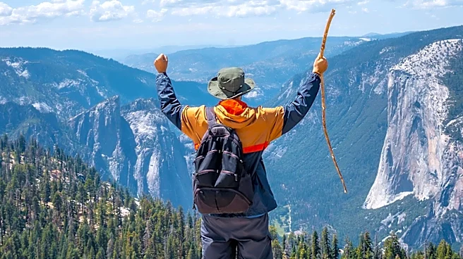
to the more crowded John Muir Trail, this route is distinct for its lack of established trails, requiring significant map-reading and route-finding skills. It traverses elevations between 9,500 and 12,500 feet, crossing over 30 mountain passes. The route is considered one of the most difficult hikes in America, demanding extensive physical and mental preparation. It begins from either the Roads End Trailhead in Kings Canyon National Park or Mono Village at Twin Lakes, near Yosemite National Park, and is divided into five sections detailed in Roper's book, 'Sierra High Route: Traversing Timberline Country.' The Sierra Nevada region, famously nicknamed the 'Range of Light' by John Muir, offers diverse scenery including alpine meadows, cobalt blue lakes, and granite peaks, alongside wildlife such as pikas, bears, mountain lions, and bighorn sheep.
Why It's Important?
The recognition of the Sierra High Route as a premier hiking destination highlights the unique and challenging wilderness experiences available in the United States. This designation could draw increased attention to the Sierra Nevada region, potentially boosting local tourism in areas surrounding Kings Canyon and Yosemite National Parks, though the route's difficulty will naturally limit participation. For the outdoor recreation industry, it underscores the demand for extreme adventure gear and specialized navigational tools. The emphasis on self-reliance and advanced wilderness skills also promotes a deeper appreciation for conservation and responsible outdoor practices, as hikers must be well-prepared for remote conditions and potential wildlife encounters. This type of recognition also reinforces California's reputation as a leading state for diverse and challenging outdoor activities, attracting experienced hikers seeking unparalleled natural beauty and solitude.
What's Next?
Prospective hikers considering the Sierra High Route will need to undertake rigorous preparation, including studying Steve Roper's guide, carrying detailed maps and GPS, and securing wilderness permits, which vary by area and are available on Recreation.gov. The optimal hiking season is typically July to September, as snow can make the route impassable outside these months. Hikers should plan for two to three weeks to complete the route, depending on conditions and individual ability, and must carry essential supplies like bear canisters, water filters, and satellite communicators due to the lack of cell service. Red's Meadow offers a resupply point for those undertaking the full route. For less experienced individuals, the option to complete sections of the route via various access trails remains a viable alternative, allowing for a gradual introduction to the challenging terrain.
Beyond the Headlines
The Sierra High Route represents more than just a physical challenge; it embodies a philosophy of wilderness exploration that prioritizes solitude, self-sufficiency, and deep engagement with nature. Unlike well-trodden trails, its unmarked paths foster a profound connection to the landscape and demand a heightened sense of awareness and respect for the environment. This type of extreme hiking experience can serve as a powerful counter-narrative to increasingly digitized lifestyles, offering a rare opportunity for disconnection and introspection. Ethically, the route's low traffic helps preserve its pristine condition, but any increase in popularity necessitates careful management to prevent environmental degradation. Legally, the permit system and regulations in national parks and wilderness areas aim to balance access with conservation, ensuring that the unique ecological and aesthetic values of the Sierra Nevada are protected for future generations, while also promoting safety in remote areas.