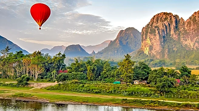










Laos, a landlocked country in Southeast Asia, is known for its diverse and mountainous terrain. Bordered by Myanmar, China, Vietnam, Cambodia, and Thailand, Laos covers approximately 236,800 square kilometers. This article explores the geographical features of Laos, highlighting its topography, borders, and natural resources.
Mountainous Terrain and River Systems
The geography of Laos is predominantly mountainous, with about 70% of its area consisting of mountain ranges, highlands, and plateaus.
The Annamite Range in the northeast and east, along with the Luang Prabang Range in the northwest, are notable features of the country's landscape. These ranges are characterized by steep terrain and elevations typically above 500 meters, interspersed with river valleys.
The Mekong River, one of the most significant rivers in Southeast Asia, forms much of Laos's western border. It serves as a vital transportation artery, with cargo boats traveling along its length during most of the year. Smaller power boats and pirogues are also used for transportation on the Mekong's tributaries. The river's importance is underscored by its role in demarcating borders and facilitating trade and travel.
Borders and Neighboring Countries
Laos shares its borders with five countries, each contributing to its unique geographical and cultural landscape. To the north, Laos is bounded by a 423-kilometer border with China, while the eastern border with Vietnam extends for 2,130 kilometers along the crest of the Annamite Chain. This mountain range acts as a natural barrier between the Chinese-influenced culture of Vietnam and the Indianized states of Laos and Thailand.
The southern border with Cambodia stretches for 541 kilometers, with historical Khmer ruins attesting to the long-standing contact between the Lao and Khmer peoples. In the northwest, Laos shares a 235-kilometer-long Mekong River border with Myanmar. The river's role as a border was established by French colonial forces, and travel across it has been limited since the establishment of the Lao People's Democratic Republic in 1975.
Natural Resources and Land Use
Laos is endowed with abundant natural resources, including hydropower potential from its river systems. The southern "panhandle" of the country, particularly in Savannakhét and Champasak provinces, is more suited for paddy rice cultivation and livestock raising. However, much of the land remains mountainous, with only about 4% classified as arable.
The forested land area in Laos has declined since the 1970s due to commercial logging and expanded swidden, or slash-and-burn, farming. Despite these challenges, the country's natural resources continue to play a crucial role in its economy and development.
In summary, the geography of Laos is defined by its mountainous terrain, extensive river systems, and strategic borders with neighboring countries. These features have shaped the country's cultural and economic landscape, making it a unique and diverse nation in Southeast Asia.