








Hurricane Andrew stands as a significant event in meteorological history, not only for its destructive power but also for its rapid intensification and multiple landfalls. Originating as a tropical depression, the storm underwent a dramatic transformation, evolving into a Category 5 hurricane that would leave an indelible mark on the Bahamas, Florida, and Louisiana. Understanding its meteorological journey, from its humble beginnings to its eventual
dissipation, provides crucial insights into the dynamics of powerful Atlantic hurricanes and the challenges they pose to coastal communities.
From Tropical Depression to Category 5 Powerhouse
Hurricane Andrew began its life as a tropical depression over the eastern Atlantic Ocean on August 16, 1992. For about a week, it remained in the central Atlantic without significant strengthening. However, this period of relative calm was followed by a rapid and alarming intensification. By August 23, the storm had transformed into a powerful Category 5 hurricane, moving westward towards The Bahamas. This rapid intensification was a critical turning point in Andrew's development, setting the stage for the severe impacts that would follow.Early on August 22, Andrew attained hurricane status, approximately 650 miles (1,050 km) east-southeast of Nassau, Bahamas. Initially, forecasters underestimated both the strength and speed of the storm. A forecast issued six hours after it became a hurricane predicted it would make landfall near Jupiter, Florida, with winds of 105 mph (169 km/h) on August 25. However, post-analysis revealed that the storm was often stronger than operationally reported between early on August 22 and early on August 26. In real time, the National Hurricane Center assessed its peak intensity as 150 mph (240 km/h), which was later upgraded to 155 mph (249 km/h) in a post-storm analysis. A 2004 paper further concluded that Andrew became a Category 5 hurricane near the Bahamas on August 23, reaching maximum sustained winds of 175 mph (282 km/h).
Landfalls in the Bahamas and Florida
Andrew first inflicted structural damage as it moved through the Bahamas, particularly in Cat Cays. It lashed the islands with storm surge, hurricane-force winds, and tornadoes, destroying about 800 houses and causing substantial damage to various sectors including transport, water, sanitation, agriculture, and fishing. The storm left four people dead and caused $250 million in damage throughout The Bahamas.After traversing The Bahamas, Andrew briefly weakened to Category 4 status but quickly regained Category 5 intensity before making its first U.S. landfall. This occurred on Elliott Key and then Homestead, Florida, on August 24. At the time of its Florida landfall, Andrew had a barometric pressure of 922 hPa (27.23 inHg), making it the sixth most-intense hurricane to strike the United States. The storm was found to have briefly re-intensified into a Category 5 hurricane around the time of landfall in South Florida. Passing directly through the cities of Cutler Bay and Homestead in Dade County (now Miami-Dade County), the hurricane caused catastrophic damage, stripping many homes of all but their concrete foundations. In Florida, Andrew killed 44 people and caused a then-record $25 billion in damage.
Journey to Louisiana and Final Dissipation
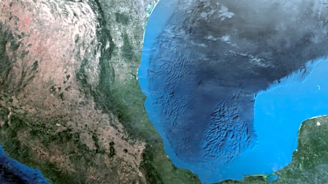
Several hours after its devastating impact on Florida, Hurricane Andrew emerged over the Gulf of Mexico at Category 4 strength, with the Gulf Coast of the United States directly in its path. The storm then turned northwestward and continued to weaken. On August 26, at 08:30 UTC, Andrew moved ashore near Morgan City, Louisiana, as a low-end Category 3 storm, with winds of 115 mph (185 km/h). Although the landfall winds in Louisiana were initially assessed as 120 mph (193 km/h), post-analysis later decreased this to 115 mph (185 km/h).After making landfall in Louisiana, the small hurricane curved northeastward and rapidly lost its intensity. It fell to tropical storm intensity within 10 hours. By early on August 27, after entering Mississippi, the cyclone weakened further into a tropical depression. Accelerating northeastward, the depression began merging with an approaching frontal system. By midday on August 28, Andrew had lost its tropical characteristics while located over the southern Appalachian Mountains, becoming an extratropical cyclone. The remnants of the storm continued their northeastward movement, fully merging with the remnants of Hurricane Lester and a frontal zone over Pennsylvania on August 29, marking the complete dissipation of Hurricane Andrew.