





Nigeria, located in West Africa, is a country with a rich tapestry of geographical features and climate zones. From its coastal regions along the Gulf of Guinea to the highlands near the Cameroon border, Nigeria's landscape is as varied as it is vast. This diversity not only shapes the country's natural beauty but also influences its climate, agriculture, and way of life.
Coastal and Riverine Features
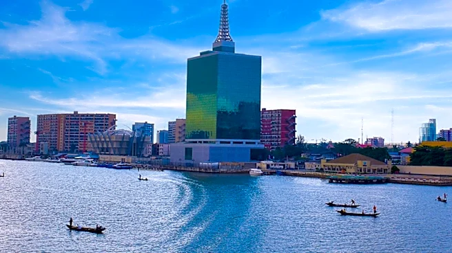
Nigeria's southern boundary is defined by its coastline along the Gulf of Guinea,
stretching approximately 853 kilometers. This coastal region is characterized by mangrove swamps, particularly in the Niger Delta, which is one of the world's largest river deltas. The delta is a crucial ecological zone, supporting a wide range of biodiversity and serving as a vital area for fishing and agriculture.
The Niger and Benue Rivers are Nigeria's principal waterways, converging to form a Y-shape that dominates the country's central region. These rivers are not only important for transportation and trade but also play a significant role in the country's agriculture, providing water for irrigation and supporting fertile lands along their banks.
Plateaus and Highlands
Moving inland, Nigeria's topography becomes more varied with several plateaus and highlands. The Jos Plateau, located in the central part of the country, is known for its cooler climate and rich mineral resources. Further east, the Mambilla Plateau, which extends into Cameroon, is Nigeria's highest plateau, offering a temperate climate and stunning landscapes.
The Adamawa Plateau, situated in the northeastern part of Nigeria, is another significant highland area. It is home to Chappal Waddi, Nigeria's highest point at 2,419 meters. These highlands are not only scenic but also support diverse ecosystems and are important for agriculture and livestock grazing.
Climate Zones
Nigeria's climate is as diverse as its geography, with four major climate types ranging from tropical monsoon in the south to semi-arid in the north. The southern regions experience heavy rainfall, especially in the Niger Delta, where annual precipitation can exceed 4,000 millimeters. This abundant rainfall supports lush vegetation and dense forests.
In contrast, the northern part of Nigeria is characterized by a hot semi-arid climate, with much less rainfall and higher temperatures. This region is part of the Sahel, where desertification is a growing concern. The central part of the country, including the capital Abuja, experiences a tropical savanna climate with distinct wet and dry seasons.
Nigeria's geographical diversity is a defining feature of the country, influencing its climate, natural resources, and the livelihoods of its people. From the coastal mangroves to the highland plateaus, Nigeria's landscape is a testament to the country's rich natural heritage.