





Hurricane Irma, a powerful Category 5 Atlantic hurricane in 2017, left a trail of significant damage across multiple regions, from the Leeward Islands to the United States. Its immense strength and broad reach meant that even areas not directly hit by landfall experienced considerable destruction. The storm's impact was particularly severe in the Caribbean, where it became the second-costliest hurricane on record for the region, surpassed only by Hurricane Maria.
This article will trace Irma's devastating journey and highlight the varied effects it had on the communities in its path.
Initial Landfalls and Peak Intensity in the Leeward Islands
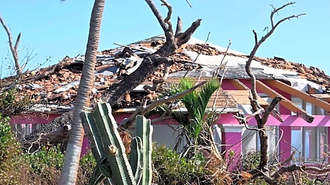
Irma made its first landfall on Barbuda early on September 6, at its peak intensity. A weather station on the island recorded a wind gust of 160 mph (260 km/h) and a minimum barometric pressure of 916.1 mbar (27.05 inHg). Communication with Barbuda was cut off for hours after Irma's passage due to downed phone lines, leaving the exact state of the island unknown. Prime Minister Gaston Browne later surveyed the territory by helicopter, revealing an island that was effectively uninhabitable. The hurricane damaged or destroyed 95% of Barbuda's structures, including its hospital, schools, and both hotels. Some residential blocks were completely flattened, while others were submerged. The destruction rendered the island's sole airport and much of its infrastructure, including water and telecommunication services, inoperative, which further hindered relief efforts. Property damage on Barbuda was estimated to be between $150 million and $300 million, and three storm-related deaths were reported.Beyond the human impact, there was significant concern for Barbuda's wildlife. The Barbuda warbler, the island's only endemic bird, numbered fewer than 2,000 individuals before the hurricane. While its survival was initially uncertain, it was later confirmed that most of the birds survived the storm. Codrington Lagoon, home to the Caribbean's largest colony of magnificent frigatebirds, with an estimated 2,500 nesting pairs, was also inundated by the storm surge. In contrast, Antigua, which remained just outside Irma's strongest wind field, sustained less severe damage, primarily leveled roofs and fences, downed power poles and lines, and uprooted trees. Some street flooding occurred in low-lying areas, and three people were treated for minor storm-related injuries. Economic losses for Antigua and Barbuda were estimated to exceed $120 million.
Devastation in Saint Martin and Anguilla
On the morning of September 6, Irma's center crossed the island of Saint Martin at peak intensity, causing widespread destruction. Entire structures were swept away, roads and cars were submerged, and an island-wide blackout occurred. The extreme winds uprooted trees and scattered vehicles and debris from damaged buildings across the territory. In Marigot, on the French side of Saint-Martin, marinas were left in ruins, filled with the remnants of boats that had collided. A hotel caught fire, but dangerous conditions and impassable roads prevented firefighters from reaching it. Another hotel lost nearly its entire ground floor. Media images showed devastated room interiors with furniture thrown around after windows were shattered. Four people died on the French side of the island, and 50 were injured, one critically. As many as 95% of the buildings were damaged, with 60% deemed totally uninhabitable. Economic losses were estimated at a minimum of $950 million, with total losses exceeding €3.5 billion (US$4.17 billion).A similar scenario unfolded in Sint Maarten, the Dutch half of Saint Martin, where intense winds tore through buildings and lifted vehicles. Princess Juliana International Airport suffered severe damage, with large sections of the building strewn across the runway and a jet bridge snapped in half. Approximately 70% of Sint Maarten's houses were demolished or severely damaged, forcing thousands into public shelters. Four deaths and 23 injuries, 11 of them serious, were reported in the Dutch territory. Irma is considered the worst natural disaster to hit Sint Maarten, with damage far exceeding any previous hurricane. Total damages were estimated at €2.5 billion (US$2.98 billion).
The British Overseas Territory of Anguilla also experienced the storm's eyewall on September 6. Many homes and schools were destroyed, and the island's only hospital was badly damaged. The devastation was particularly severe in East End, where winds uprooted numerous trees and power poles and demolished several houses. In The Valley, the capital, the hurricane blew out the windows of government buildings. Rough seas caused heavy damage to several bays and harbors, and a seaside restaurant was completely destroyed. About 90% of roads became impassable. The island's air traffic control tower was damaged, worsening communication issues. One death was reported, and losses were estimated at least $190 million.
Impact on the U.S. Virgin Islands and Puerto Rico
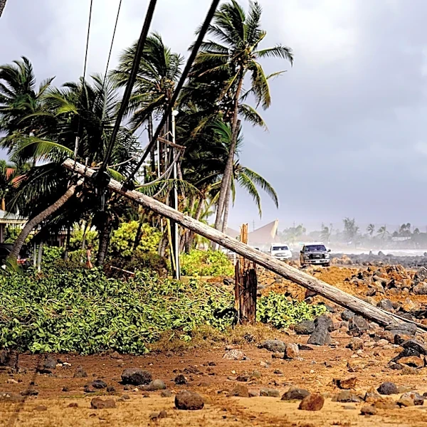
In the U.S. Virgin Islands, Irma's effects were most pronounced on Saint Thomas and Saint John. Saint Thomas experienced widespread structural damage, including to its police station and airport. Patients from the upper floors of Charlotte Amalie's hospital had to be moved to lower floors due to roof leaks and flooding. Three deaths were attributed to Irma on Saint Thomas. On nearby Saint Croix, communication issues and some infrastructure damage occurred. Saint John lost access to ferry and cargo services, as well as its local airport, and was left without power due to its reliance on electricity from Saint Thomas. Total damage across the three islands was at least $1.1 billion.Although Hurricane Irma passed north of Puerto Rico, it still caused significant damage to the U.S. territory. A tide gauge observed waves up to 1.5 ft (0.46 m) mean higher high water along the coast. Much of the main island experienced sustained tropical storm force winds, with a peak sustained wind speed of 55 mph (89 km/h) at a weather station along San Juan Bay, which also recorded a peak wind gust of 74 mph (119 km/h). On the island of Culebra, a wind gust of 111 mph (179 km/h) was reported. Strong winds led to approximately 1.1 million out of 1.5 million Puerto Rico Electric Power Authority customers losing electricity. Heavy rainfall, peaking at 13.04 in (331 mm) in Bayamón, caused seven rivers to reach flood stage, widespread flash flooding, and at least six landslides. The offshore islands of Culebra and Vieques, as well as the northeastern, northern, and mountainous parts of the main island, were most severely affected. Culebra suffered an almost complete loss of electrical and water services, with at least 30 homes destroyed and about 30 others substantially damaged. High winds toppled numerous trees, and the island's only telecommunications tower was damaged, cutting off outside communications for several hours. In rural Loíza, 79 homes were destroyed. Across Puerto Rico, 781 out of 1,600 telecommunications towers went out of commission, mainly due to power outages. At least 362,000 customers lost water services. Debris, primarily fallen trees, blocked at least 72 roads. Approximately 25% to 30% of banana, coffee, papaya, and plantain crops were damaged, with losses to farmers estimated at $30.6 million. About 1,530 homes experienced at least moderate damage, with 1,448 moderately damaged, 32 extensively damaged, and 50 completely destroyed. Hurricane Irma was attributed to around $1 billion in damage, and the NHC attributed three fatalities to Irma in Puerto Rico, though four deaths were related to the storm. Governor Ricardo Rosselló declared Culebra and Vieques disaster areas.
The Bahamas, Cuba, and Florida Landfalls
After clearing the Leeward Islands, Irma continued west-northwestward toward The Bahamas. Around the time of landfall on Little Inagua Island early on September 8, Irma weakened to a Category 4 hurricane, after being a Category 5 hurricane for about 60 consecutive hours, the second longest contiguous time period as a Category 5 hurricane on record. At 05:00 UTC on September 8, the eye of Irma made landfall on Little Inagua with winds of 155 mph (249 km/h) and a central pressure of 924 mbar (27.3 inHg). The hurricane then tracked more to the west due to the intensification of a subtropical ridge to its north. Once an eyewall replacement cycle was completed, Irma re-intensified, re-attaining Category 5 intensity at 18:00 UTC that day east of Cuba, as deep convection became more pronounced and organized. The hurricane then made landfall in Cayo Romano, Cuba, at 03:00 UTC on September 9, at Category 5 intensity, with winds of 165 mph (266 km/h) and a central pressure identical to its previous landfall. This made Irma only the second Category 5 hurricane to strike Cuba in recorded history, after the 1924 Cuba hurricane, both having identical wind speeds at landfall. As the eye moved along Cuba's northern coast, gradual weakening occurred due to land interaction, with the eye becoming cloud-filled and the intensity falling to a high-end Category 2 later on September 9. By later that night, Irma's forward speed slowed, allowing it to begin moving northwestward toward Florida in response to a complex steering pattern. Moving over the Florida Straits, with sea surface temperatures near 31 °C (88 °F), Irma quickly restrengthened, re-attaining Category 4 intensity at 06:00 UTC on September 10, about 65 miles (105 km) from Key West, Florida. By this time, Irma's wind field continued to increase in size, with hurricane-force winds spanning a region of 80 miles (130 km) and gale-force winds spanning 220 miles (350 km) in diameter.Irma made landfall in Cudjoe Key, Florida, at 13:00 UTC on September 10, at Category 4 intensity, with winds of 130 mph (210 km/h) and a central pressure of 931 mbar (27.5 inHg). This marked Irma as the first Category 4 hurricane to strike Florida since Hurricane Charley in 2004. Additionally, Irma's landfall in the Florida Keys was the first time on record that two Category 4 hurricanes made landfall in the continental U.S. within the same season, with Hurricane Harvey having made landfall at roughly the same intensity in Texas just over two weeks prior. Increasing wind shear and land interaction caused the storm's satellite appearance to become ragged later that day, and Irma weakened to Category 3 intensity before making its seventh and final landfall at 19:30 UTC in Marco Island, Florida, with winds of 115 mph (185 km/h) and a central pressure of 936 mbar (27.6 inHg). Once inland, Irma accelerated north-northwestward, and rapid weakening began due to increasing wind shear, land interaction, and dry air, with the storm falling below Category 3 intensity hours after landfall. Passing east of Tampa as a weakening Category 1 hurricane around 06:00 UTC on September 11, Irma continued to weaken as most of the deep convection became more spread out toward the northern semi-circle of the circulation, though it retained a large wind field, with most of Florida experiencing gale-force winds. Irma finally weakened to a tropical storm around 12:00 UTC that day as it entered southern Georgia and began its transition to a post-tropical cyclone. At 06:00 UTC on September 12, Irma degenerated to a remnant low just as it entered Alabama, as most of the deep convection had dissipated. The remnants persisted for another day or so before dissipating on September 13.