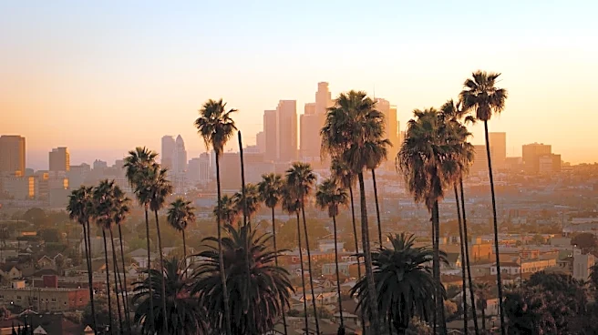






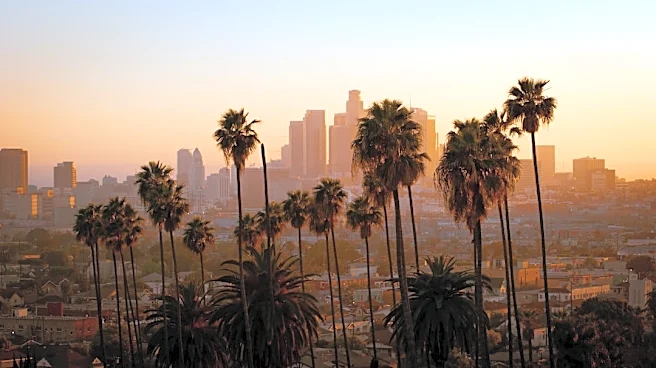
Los Angeles, a sprawling metropolis in California, is defined not just by its urban landscape but also by its striking natural surroundings. The city's geography plays a significant role in shaping its character, from the towering mountains that frame its northern edge to the vast valleys and diverse microclimates that characterize the region. This unique blend of natural features and urban development has created a complex and often challenging environment
for its residents.
Mountainous Borders and Expansive Reach
Immediately to the north of Los Angeles lie the San Gabriel Mountains, a popular recreational area for locals. The highest point in this range is Mount San Antonio, affectionately known as Mount Baldy, which reaches an elevation of 10,064 feet (3,068 m). Further east, about 81 miles (130 km) from downtown Los Angeles, stands San Gorgonio Mountain, the highest point in southern California, at 11,503 feet (3,506 m). These formidable mountain ranges contribute to the city's distinct microclimates and offer a dramatic backdrop to the urban expanse.
The city itself covers a substantial area of 502.7 square miles (1,302 km²), with 468.7 square miles (1,214 km²) being land and 34.0 square miles (88 km²) water. Its dimensions are impressive, extending 44 miles (71 km) from north to south and 29 miles (47 km) from east to west, with a perimeter stretching 342 miles (550 km). This vast area encompasses a variety of terrains and communities, contributing to the city's diverse character.
Urban Form and Development Patterns
Los Angeles is often characterized by its prevalence of low-rise buildings, a stark contrast to cities like New York. While downtown Los Angeles boasts numerous buildings over 30 stories, including fourteen over 50 stories and two over 70 stories (with the Wilshire Grand Center being the tallest), skyscrapers and high-rise structures are less common outside of a few key centers. These centers include Warner Center, Century City, Koreatown, Miracle Mile, Hollywood, and Westwood. The city's street patterns generally follow a grid plan, featuring uniform block lengths, though this is complicated by rugged terrain, necessitating different grids for each of the valleys Los Angeles covers.
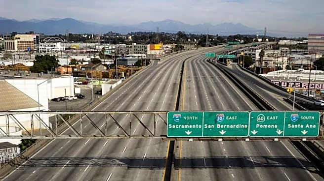
Major streets are designed to handle large volumes of traffic, with many being exceptionally long; Sepulveda Boulevard, for instance, spans 43 miles (69 km), and Foothill Boulevard extends over 60 miles (97 km), reaching as far east as San Bernardino. This extensive road network is a necessity, as Los Angeles drivers experience some of the worst rush hour periods globally, spending an additional 92 hours in traffic annually, with peak congestion reaching 80%.
Microclimates and Water Security Challenges
Due to its mountainous terrain, the Los Angeles area is home to a large number of distinct microclimates, leading to extreme temperature variations over short distances. For example, the average July maximum temperature at the Santa Monica Pier is 70 °F (21 °C), while just 15 miles (24 km) away in Canoga Park, it can reach 95 °F (35 °C). The city experiences a two-season semi-arid climate with dry summers and mild to warm winters, receiving more annual precipitation than most semi-arid climates, narrowly missing the classification of a Mediterranean climate. Daytime temperatures are generally temperate year-round, averaging around 68 °F (20 °C) in winter. Autumn months can be hot, with major heat waves common in September and October, while spring tends to be cooler and wetter. Los Angeles enjoys abundant sunshine, with over 3,000 hours annually and only about 35 days of measurable precipitation.
Downtown Los Angeles averages 14.67 inches (373 mm) of precipitation annually, primarily from November to March, usually as moderate rain showers, though heavy rainfall can occur during winter storms. Rainfall is typically higher in the hills and coastal mountain slopes due to orographic uplift. Summer days are usually rainless, though brief thunderstorms can occur in late summer, especially in the mountains. The region's water security has been increasingly strained by statewide droughts in California, making it a significant development issue. Freezing temperatures and snowfall are extremely rare in the city basin and along the coast, with the last 32 °F (0 °C) reading at the downtown station recorded in 1979. However, valley locations experience freezing temperatures almost every year, and the mountains within city limits typically receive snow each winter. The highest recorded temperature within the city was 121 °F (49 °C) at Pierce College in Woodland Hills in 2020, while the lowest downtown was 28 °F (−2 °C) in 1949. Santa Ana winds during autumn and winter can bring warmer, drier conditions and increase wildfire risk.