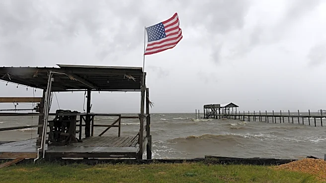







Hurricane Michael, a powerful and destructive tropical cyclone, made history in 2018 as the first Category 5 hurricane to make landfall in the contiguous United States since Hurricane Andrew in 1992. This formidable storm was also the strongest hurricane to ever strike the Florida Panhandle and the most intense hurricane on record to hit the U.S. in October. Its journey from a broad low-pressure area in the Caribbean to a catastrophic Category 5 storm highlights
the rapid intensification potential of tropical cyclones and the severe consequences for coastal communities.
Genesis and Early Development
Michael's origins can be traced back to a broad low-pressure area that formed in the southwestern Caribbean Sea around October 1, 2018. This disturbance absorbed the remnants of Tropical Storm Kirk, contributing to its development. Initially, the National Hurricane Center (NHC) anticipated that strong upper-level winds would hinder significant development for a few days. However, a tropical wave, an elongated trough of low air pressure, tracked into the area, potentially increasing thunderstorm activity and leading to the formation of a surface low southwest of Jamaica by October 3.
Despite initial predictions for a northward trajectory, the low tracked west-southwestward, moving ashore in northeastern Honduras on October 4. It then became integrated into a broad cyclonic gyre over Central America. A center from the eastern Pacific moved across Central America on October 6 and also integrated into this gyre, which reformed over the northwestern Caribbean Sea on the same day. Due to the imminent threat to land, the NHC began issuing advisories for this system as Potential Tropical Cyclone Fourteen on October 6.
Rapid Intensification in the Gulf of Mexico
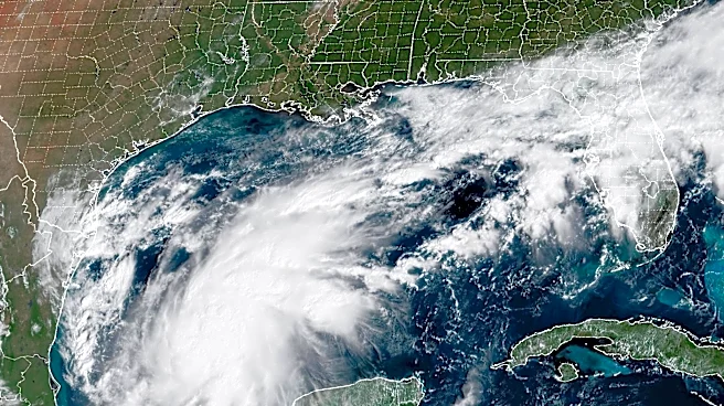
As the system moved northward, it encountered an environment of warm sea surface temperatures, ranging from 82–86 °F (28–30 °C), which proved conducive for intensification. Despite some initial wind shear from an upper-level trough over the Gulf of Mexico, the system's convection and circulation began to improve. On October 7, it strengthened into a tropical depression approximately 150 miles (240 km) south of Cozumel, Mexico, and then into Tropical Storm Michael later that day. The storm then began a period of rapid intensification, defying initial NHC predictions that expected a peak intensity of 70 mph (110 km/h) due to anticipated persistent wind shear.
Two key factors are believed to have facilitated Michael's rapid strengthening: diffluence from an upper-level trough counteracting wind shear, and Michael's outflow entering another upper-level trough east of the storm. By October 8, Michael had become a Category 1 hurricane, with an eye beginning to appear in satellite imagery. It reached an initial peak as a Category 2 hurricane with winds of 100 mph (160 km/h) as it passed west of Cabo del San Antonio, Cuba. Although its eyewall temporarily degraded overnight due to a cold water eddy, dry air, and wind shear, Michael resumed rapid intensification by October 9 over the warm waters of the Gulf of Mexico. Its eye became better defined, and outflow improved as westerly shear decreased. It quickly strengthened into a Category 3 major hurricane, with cloud temperatures in its eyewall dropping as low as -126 °F (-88 °C).
Landfall and Catastrophic Damage
Michael continued its northward trek, accelerating northeastward under the influence of the westerlies. On October 10, the outer rainbands began to move ashore, and the hurricane reached its peak intensity as a Category 5 hurricane with maximum sustained winds of 160 mph (260 km/h) and a minimum central pressure of 919 mbar (27.14 inHg). It made landfall near Tyndall Air Force Base in Florida at approximately 1:30 PM UTC. This made it the fourth-strongest landfalling hurricane in the contiguous United States in terms of wind speed.
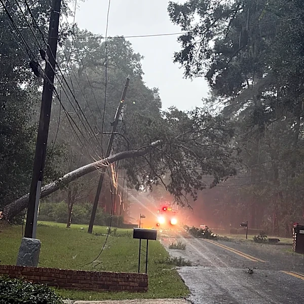
The impact on the Florida Panhandle was catastrophic. The cities of Mexico Beach and Panama City bore the brunt of the storm, suffering immense damage from extreme winds and storm surge. Numerous homes were flattened, and trees were felled across a wide area. Tyndall Air Force Base recorded a maximum wind gust of 139 mph (224 km/h) before its sensors failed, with radar estimates suggesting even stronger winds of 178 mph (286 km/h) in some areas. The damage at Tyndall Air Force Base alone included an estimated $6 billion replacement cost for U.S. fighter jets. Statewide economic damage in Florida was estimated at $18.4 billion, with total damages from the storm reaching $25.1 billion (2018 USD) across all affected areas, including over $3.87 billion in agricultural losses. Michael's destructive path left a lasting scar on the region, highlighting the immense power of rapidly intensifying hurricanes.
Inland Weakening and Extratropical Transition
After making landfall, Michael rapidly weakened. Within just four hours, it had fallen below Category 3 status as it moved into southwestern Georgia. The storm continued its northeastward trajectory, weakening to a high-end Category 1 hurricane and then to a tropical storm. As it entered North Carolina on October 11, Michael began its transition into an extratropical cyclone, with cold, dry air entraining into its circulation. By October 12, it was fully extratropical, passing near Norfolk, Virginia, and emerging into the Atlantic. The extratropical cyclone then restrengthened to hurricane-force winds over the Atlantic before eventually dissipating near the Iberian Peninsula on October 16, after briefly interacting with the remnants of Hurricane Leslie.