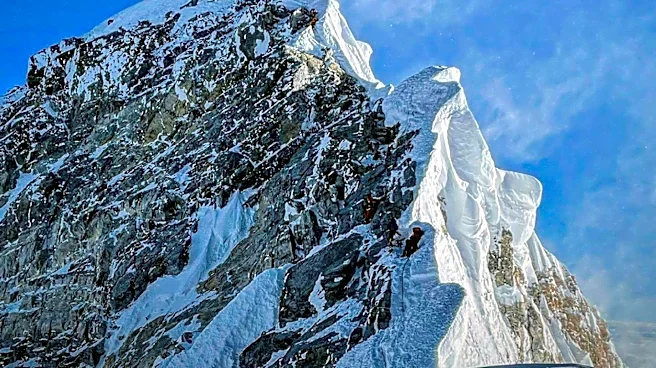






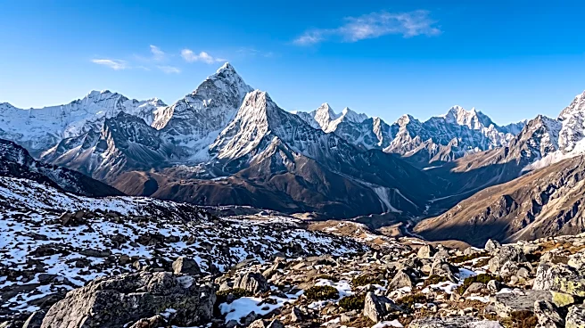
Mount Everest, the Earth's highest mountain above sea level, has a rich history tied to its discovery, measurement, and naming. For centuries, its immense height remained a mystery to the Western world, hidden behind the formidable Himalayan range and political barriers. The journey to accurately determine its elevation and bestow upon it the name we know today involved dedicated surveyors, complex calculations, and even some debate over local appellations.
The Great Trigonometrical Survey of India
The story of Mount Everest's measurement begins in 1802 with the British Great Trigonometrical Survey of India. This ambitious undertaking aimed to map the locations, heights, and names of the world's highest mountains. The survey teams started in southern India and gradually moved northward, employing giant theodolites, each weighing 500 kg (1,100 lb) and requiring 12 men to carry, to achieve the most accurate measurements possible. By the 1830s, these teams had reached the Himalayan foothills. However, Nepal, suspicious of British intentions, denied their requests to enter the country, forcing the British to conduct their observations from the Terai, a region south of Nepal that runs parallel to the Himalayas.Conditions in the Terai were extremely challenging due to torrential rains and malaria. Several survey officers succumbed to malaria, and others had to retire due to failing health. Despite these obstacles, the British continued their observations from stations up to 240 km (150 mi) distant. In November 1847, Andrew Scott Waugh, the British Surveyor General of India, made several observations from the Sawajpore station at the eastern end of the Himalayas. At this time, Kangchenjunga was considered the world's highest peak. Waugh, however, noted a peak beyond it, approximately 230 km (140 mi) away, which he designated as peak "b." John Armstrong, one of Waugh's subordinates, also observed this peak from a more western location.
Identifying the World's Highest Peak
Waugh's initial observations suggested that peak "b" was higher than Kangchenjunga, but he recognized that closer observations were necessary for verification. The following year, a survey official was sent back to Terai to make more precise observations of peak "b," but his efforts were thwarted by clouds. In 1849, Waugh dispatched James Nicolson to the area. Nicolson made two observations from Jirol, 190 km (120 mi) away, and then, using the largest theodolite, obtained over 30 observations from five different locations, with the closest being 174 km (108 mi) from the peak.Nicolson retreated to Patna on the Ganges to perform the necessary calculations based on his observations. His raw data indicated an average height of 9,200 m (30,200 ft) for peak "b." However, this figure did not account for light refraction, which distorts heights. Despite this, the data clearly suggested that peak "b" was indeed higher than Kangchenjunga. Unfortunately, Nicolson contracted malaria and was forced to return home before completing his calculations. Michael Hennessy, one of Waugh's assistants, began designating peaks using Roman numerals, with Kangchenjunga named Peak IX. Peak "b" subsequently became known as Peak XV.
The Naming Controversy and Official Recognition
In 1852, Radhanath Sikdar, an Indian mathematician and surveyor stationed at the survey headquarters in Dehradun, was the first to identify Peak XV as the world's highest peak using trigonometric calculations based on Nicolson's measurements. The official announcement was delayed for several years as the calculations underwent repeated verification. Waugh began working on Nicolson's data in 1854, and he and his staff spent almost two years meticulously analyzing the numbers, addressing issues such as light refraction, barometric pressure, and temperature over the vast distances of the observations.Finally, in March 1856, Waugh announced his findings in a letter to his deputy in Calcutta. He declared Kangchenjunga to be 8,582 m (28,156 ft) and Peak XV to be 8,840 m (29,002 ft). Waugh concluded that Peak XV was "most probably the highest in the world." Interestingly, the calculated height of Peak XV in feet was exactly 29,000 ft (8,839.2 m), but it was publicly declared as 29,002 ft (8,839.8 m) to avoid the impression that an exact height of 29,000 ft was merely a rounded estimate. Waugh is sometimes humorously credited with being "the first person to put two feet on top of Mount Everest."
In 1865, the Royal Geographical Society officially renamed Peak XV to Mount Everest in honor of Sir George Everest, Waugh's predecessor as Surveyor General of India. Waugh had proposed this name in 1856, stating that he could not discover any local name for the mountain, and that a native appellation was unlikely to be ascertained before the British were allowed into Nepal. While there were indeed several native names among the Nepalese and Tibetans, these areas were inaccessible to the British at the time. Everest himself initially objected to the honor, believing his name was not easily pronounced or written in Hindi, and that he had no direct connection to the mountain's discovery. However, the name Mount Everest ultimately prevailed.