




Georgia, a country situated in the Caucasus region, boasts a remarkably varied topography despite its relatively small size. Often considered a transcontinental nation, it lies at the intersection of Eastern Europe and West Asia, generally regarded as part of Europe. This unique geographical position, coupled with its extensive mountain ranges and numerous rivers, has profoundly shaped its environment, culture, and even its challenges. The country's
landscape is a dynamic interplay of high peaks, deep gorges, and fertile lowlands, all contributing to its distinct character.
The Dominance of the Caucasus Mountains
Georgia is recognized as one of Europe's most mountainous countries, with much of its territory nestled within the vast Caucasus Mountains. The northern boundary of Georgia is partly defined by the imposing Greater Caucasus range, a significant natural feature. Running parallel to the borders with Turkey and Armenia, the Lesser Caucasus range further contributes to the country's mountainous terrain. These two major ranges are connected by the Surami Range, creating natural barriers that have historically played a role in fostering cultural and linguistic differences among Georgia's various regions. The sheer elevation of these mountains, combined with a less developed transportation infrastructure, means that many mountain villages can become virtually isolated from the outside world, especially during the harsh winter months.
Rivers Shaping the Land and Life
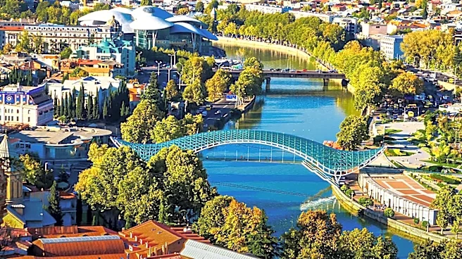
Beyond its mountains, Georgia is a land rich in water, home to approximately 25,000 rivers. Many of these rivers are harnessed to power small hydroelectric stations, indicating their importance to the country's energy infrastructure. The drainage patterns of these rivers are split, with some flowing westward into the Black Sea and others heading eastward, eventually reaching the Caspian Sea via Azerbaijan. The Kura River stands out as the largest river in Georgia, embarking on a long journey of 1,364 kilometers. It originates in northeast Turkey, traverses the plains of eastern Georgia, flows through the capital city of Tbilisi, and ultimately empties into the Caspian Sea.
Western Georgia's Waterways and Agricultural Development
In western Georgia, the Rioni River holds the distinction of being the largest waterway. This river originates in the Greater Caucasus mountains and flows westward, concluding its journey by emptying into the Black Sea at the port of Poti. The lowlands along the Black Sea coast, fed by rivers like the Rioni, were historically transformed by Soviet engineers into prime subtropical agricultural land. This involved extensive efforts to embank and straighten many stretches of the rivers and to construct a comprehensive system of canals, demonstrating a significant human impact on the natural riverine landscape. Within the Greater Caucasus, the topography is further characterized by deep mountain gorges, adding another layer of complexity and natural beauty to Georgia's diverse geographical profile.
Natural Hazards and Extreme Points
The mountainous nature of Georgia, while picturesque, also presents significant challenges in the form of natural hazards. Earthquakes and landslides are common occurrences in these elevated regions, posing a considerable threat to both human life and property. Recent history includes massive rock- and mudslides in Ajaria in 1989, which led to the displacement of thousands of people in southwestern Georgia. Additionally, two earthquakes in 1991 devastated several villages across Racha, upper Imereti, and the Tskhinvali Region, also known as South Ossetia. The country's extreme points further illustrate its geographical spread: the northernmost point (de jure) is in Abkhazia, while the de facto northernmost point is Mestia Municipality in Samegrelo-Zemo Svaneti. The southernmost and easternmost points are both located in Dedoplistsqaro Municipality, Kakheti, bordering Azerbaijan, and the westernmost point (de jure) is Abkhazia, with the de facto westernmost point in Adjara.