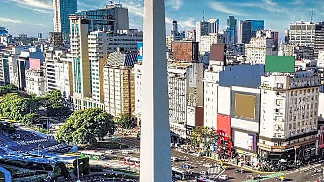






Buenos Aires Province, officially known as the Buenos Aires Province, stands as Argentina's largest and most populous province. While it shares its name with the capital city of Buenos Aires, the province itself does not include the autonomous city, which was federalized in 1880. Instead, the provincial capital is La Plata, founded in 1882. This vast region encompasses a significant portion of the Greater Buenos Aires metropolitan area, including
approximately three-fourths of its conurbation's population, and is characterized by diverse landscapes and climatic zones that profoundly influence human activities.
Expansive Geography and Key Features
Spanning 307,571 square kilometers (118,754 sq mi), Buenos Aires Province is comparable in size to Italy. Its topography is predominantly flat, a defining characteristic of The Pampas region, but it also features two notable low mountain ranges: the Sierra de la Ventana, located near Bahía Blanca, and the Sierra de Tandil, found in Tandil. The highest point within the province is Cerro Tres Picos, reaching an elevation of 1,239 meters (4,065 ft) above sea level. The longest river traversing the province is the Río Salado, which stretches for 700 kilometers (435 mi).
The province's landscape is further shaped by its inclusion in The Pampas, an area where the weather is significantly influenced by the ocean. This results in hot summers and temperate winters, accompanied by high humidity and abundant precipitation distributed throughout the year. The western and southwestern parts of the province are notably drier, forming part of the Semi-arid Pampas ecoregion. Interestingly, the southernmost section of the province is often considered part of the larger Patagonia region, adding another layer to its geographical diversity.
Diverse Climatic Regions
The climate of Buenos Aires Province is generally considered highly favorable for human activities, characterized by its temperate nature, four distinct seasons, and reliable rainfall across most areas. The province can be broadly divided into four primary climatic regions, each with unique characteristics. These include the drier southwestern region, the cool Atlantic region, the humid northern and eastern region, and the Delta region, which experiences the warmest and wettest climate.
The northern region, for instance, features warm, humid summers with daytime temperatures typically ranging from 28 to 32 °C (82 to 90 °F) and nights between 16 and 20 °C (61 and 68 °F). Falls are pleasant, while winters are cooler and drier, with highs between 13 and 18 °C (55 and 64 °F) and nights between 2 and 5 °C (36 and 41 °F). Springs are often windy and variable. Heat waves can push temperatures above 38 °C (100 °F), but these are usually short-lived, as cold fronts bring thunderstorms and cooler conditions. Conversely, winter cold waves can lead to days with highs around 8 °C (46 °F) and lows below −4 °C (25 °F), with extremes reaching −8 °C (18 °F). Snow is infrequent but has occurred. Annual precipitation in this area ranges from 750 to 1,100 mm (30 to 43 in).
Regional Climatic Variations and Administrative Structure
The Delta region, situated further north and influenced by water bodies, is slightly warmer, particularly at night. Summer nights tend to be stickier, and winters can be damp and foggy, with most nights between 4 and 8 °C (39 and 46 °F). While frost is expected, temperatures rarely drop below −4 °C (25 °F), and snow has been recorded only twice in the last century. Precipitation here is higher, ranging from 1,000 to 1,300 mm (39 to 51 in) and distributed throughout the year. The city of Buenos Aires itself, while surrounded by a climate similar to the northern province, more closely resembles the Delta climate with less frequent frost.
The southwestern region is the driest, exhibiting more pronounced temperature differences. Summers are often hot, between 30 and 35 °C (86 and 95 °F), but nights are generally comfortable (14 to 18 °C (57 to 64 °F)). Thunderstorms are less common but can be severe. Winters are cool and dry, with days between 10 and 16 °C (50 and 61 °F) and nights between −1 and 4 °C (30 and 39 °F). Frost is almost daily, with temperatures below −6 °C (21 °F) being common, and some areas recording as low as −12 °C (10 °F). Snowfall is occasional, with small accumulations. Total precipitation ranges from 500 to 750 mm (20 to 30 in), with slightly rainier springs and falls.
The Atlantic region experiences very moderate weather due to the cold ocean (17 to 20 °C (63 to 68 °F) in summer) and sea breezes. Hottest months average 25 to 27 °C (77 to 81 °F) with nights between 12 and 16 °C (54 and 61 °F). Fall is often rainy, and winters are windy and chilly, with temperatures averaging 10 to 15 °C (50 to 59 °F) and nights from 1 to 5 °C (34 to 41 °F). Frost is common, but temperatures rarely fall below −5 °C (23 °F), and significant snow accumulations are rare. Precipitation ranges from 700 to 950 mm (28 to 37 in). The Sierras de la Ventana, reaching up to 1,200 meters (3,900 ft), have cooler weather, especially at night. The province is also affected by occasional west Pampero winds and the southern Sudestada, which brings storms and temperature drops, notably the Santa Rosa storm around August 30th each year.
Administratively, Buenos Aires Province differs from other Argentine provinces in its territorial divisions, which are called partidos instead of departments. These partidos also serve as the municipal divisions. The provincial Constitution does not grant municipal autonomy, unlike the national Constitution. Each partido functions as a municipality governed by a mayor (intendente) elected by popular vote. The creation of new partidos is dynamic, with six more established between 1990 and 2000, mostly within Greater Buenos Aires. Currently, there are 135 partidos, with Lezama being the last established by law in 2009.