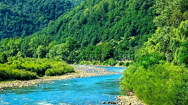







The Moksha River, a significant waterway in central Russia, serves as a right tributary of the Oka River. Its course spans across several regions, including Penza Oblast, Nizhny Novgorod Oblast, Ryazan Oblast, and the Republic of Mordovia, before it ultimately joins the Oka near Pyatnitsky Yar, close to the city of Kasimov. This river, measuring 656 kilometers (408 miles) in length, boasts a drainage basin covering an expansive 51,000 square kilometers (20,000
square miles), highlighting its considerable geographical importance in the region.
Beyond its physical attributes, the Moksha River holds cultural and historical significance. Its name is believed to be linked to the ancient Indo-European population of the Pohje, who spoke a language similar to Baltic tongues. The hydronym itself is comparable to the Indo-European root "meksha," meaning "spillage" or "leakage." It is suggested that in the language of the Indo-European aborigines, "moksha" meant "stream, current, river," a term that subsequently became part of various other hydronyms in the area.
Infrastructure and Historical Mentions
In the 1950s, several hydroelectric power stations were constructed along the middle course of the Moksha River. However, these facilities were built without navigable locks, which limited their utility for river traffic. By 1955, a hydroelectric power plant and a wooden shipping lock were established two kilometers below the river's mouth, near the Rasypukhinsky hydro-power plant. Navigation on the river continued until the mid-1990s, indicating its role in local transportation and commerce for a period.
The river is also notable for the presence of several significant religious sites along its banks, including the Trinity-Scans monastery, the Nativity-Theotokos Sanaksar Monastery, and the Krasnoslobodsky Savior-Transfiguration Monastery. These institutions underscore the historical and spiritual importance of the Moksha River to the communities in its vicinity. The name "Moksha" itself was mentioned by the monk-minorite Rubruk, an ambassador of the French King Louis IX to the Mongolian khan Sartak in 1253, indicating its recognition in historical records from that era.
The River's Source and Tributaries
The source of the Moksha River has been a subject of study. While earlier accounts, such as those in "The Nature of the Penza Region," suggested its origin above Lookout Nechaevsky, more recent research conducted in 2009-2010 indicates that the Moksha begins in a ravine from a system of springs near the village of Elizavetino. This source is located in a treeless area. The study revealed a low-lying stretch, approximately 6 kilometers (3.7 miles) long, called "Dry Moksha," where a creeping stream, 0.5 to 1.5 centimeters (0.20 to 0.59 inches) wide, flows in a hollow with a sandy and clay bottom. A constant flow of water is observed further downstream, below the confluence of a hollow from a holy spring, where the channel widens slightly. The true watercourse flows towards Vision in a poorly developed channel, with some sections experiencing bank collapse due to groundwater flowing into the channel. The bottom of the lowland where the stream flows is often swamped, and moisture-loving plants like willows, cattails, and reeds grow along its banks. This suggests that the Moksha's source is a drying creek, primarily fed by thawed and groundwater, gradually transitioning into a constant stream.
The Moksha River is fed by numerous tributaries. From its mouth to its source, these include rivers such as the Yezhachka, Tsna, Urzeva, Vad, Yermish, Shoksha, Yuzga, Vyazhka, Vedyazha, Varnava, Uzhovka, Sarma, Satis, Lomovka, Bolshoy Aksel, Urey, Shavits, Nuluy, Urkat, Sukhoy Urey, Varma, Sivin, Shapa, Gumenka, Ryabka, Linyevka, Bolshaya Azyas, Sezelka, Mokshan, Lashma, Unuy, Issa, Panzha, Sheldais, Kamora, Kaurets, Modayev, Lomovka, Atmiss, Iva, Kerka, Losma, Vyunka, Medayevka, Muromka, Skachki, Yulovka, Azyas, and Saranka.