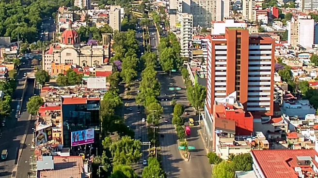





Mexico City, a sprawling metropolis and the capital of Mexico, is not governed as a single monolithic entity but rather as a unit composed of 16 distinct subdivisions known as boroughs. These boroughs, or *demarcaciones territoriales*, each possess unique demographic and geographic characteristics that contribute to the overall fabric of the city. From densely populated urban centers to more expansive, less populated areas, the boroughs showcase the diverse
nature of Mexico City's urban landscape and its administrative complexities. Understanding these divisions is key to grasping the city's internal dynamics.
The Administrative Framework of Boroughs
As of 2026, Mexico City is divided into 16 boroughs, each headed by a borough mayor, or *alcalde*. This administrative structure is distinct from the municipal organization found in other Mexican states, reflecting Mexico City's unique status as a federated entity. The term *alcaldía* is colloquially used to refer to these boroughs, highlighting the role of their mayors in local governance. This system allows for a more localized approach to administration within the vast urban area, addressing the specific needs and challenges of different neighborhoods and communities.
The traditional heart of Mexico City is encompassed by four specific boroughs: Benito Juárez, Cuauhtémoc, Miguel Hidalgo, and Venustiano Carranza. These boroughs, established in 1970 from the former circumscription of Mexico City, represent historical and cultural centers. Their formation marked a significant step in organizing the city's core into manageable administrative units, each with its own identity and responsibilities within the larger urban framework.
Population Distribution Across Boroughs
Mexico City is a highly populated entity, with 9,209,944 inhabitants recorded in the 2020 Mexican census, making it the second most populated entity in Mexico. This population is not evenly distributed among its boroughs, leading to significant variations in density and size. Iztapalapa stands out as the largest borough by population, home to a substantial 1,835,486 residents. This high concentration of people presents unique challenges and opportunities for urban planning and service provision in the area.
In contrast, Milpa Alta is the smallest borough in terms of population, with 152,685 residents. This disparity highlights the diverse living environments within Mexico City, ranging from bustling urban centers to more suburban or even semi-rural settings. Furthermore, Iztacalco is identified as the most densely populated subdivision in Mexico, indicating an extremely high concentration of people within its relatively small land area. These demographic differences necessitate tailored governance strategies for each borough.
Geographic Footprint and Density
Beyond population, the boroughs also vary significantly in their geographic size. Tlalpan is the largest borough by land area, spanning 314.50 square kilometers (121.43 sq mi). Its expansive territory likely includes a mix of urban development and possibly more natural or less developed areas, contributing to its larger footprint. On the other hand, Iztacalco is the smallest borough by land area, covering just 23.10 square kilometers (8.92 sq mi).
The combination of Iztacalco's small land area and its status as the most densely populated subdivision underscores the intense urbanization and compact living conditions prevalent in certain parts of Mexico City. These geographic and demographic contrasts between boroughs illustrate the complexity of governing such a large and diverse urban center. The administrative divisions are crucial for managing resources, infrastructure, and public services across the varied landscapes and communities that make up Mexico City.