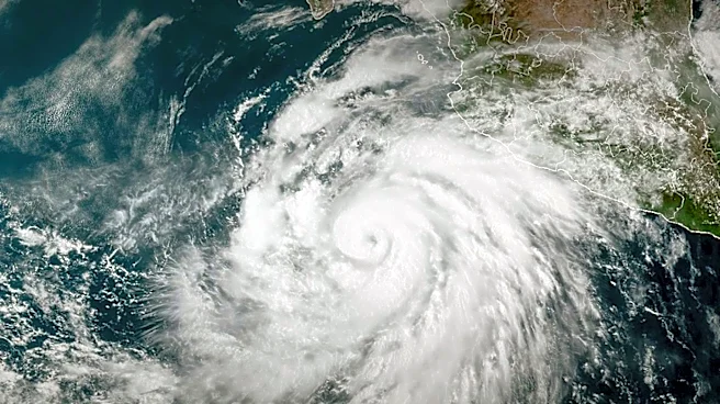







Hurricane Irma, a powerful and long-lived Atlantic hurricane in 2017, exhibited a complex meteorological history marked by rapid intensification, sustained extreme strength, and multiple landfalls. Its journey from a developing cyclone to a dissipating remnant low involved significant changes in intensity and trajectory, influenced by various atmospheric and oceanic conditions. This article provides a chronological overview of Irma's meteorological evolution,
detailing its peak intensities, land interactions, and eventual weakening.
Early Intensification and Caribbean Dominance
Hurricane Irma's meteorological story began with its formation and subsequent rapid intensification. The storm quickly grew in strength, reaching its peak intensity as it approached the Leeward Islands. Early on September 6, Irma made its first landfall on Barbuda at this peak intensity. Later that same day, the hurricane also struck Saint Martin and Virgin Gorda in the British Virgin Islands, maintaining its Category 5 intensity. These initial landfalls in the Caribbean marked the beginning of Irma's devastating impact on the region.Upon clearing the Leeward Islands, the cyclone continued its west-northwestward movement toward The Bahamas. Around the time of its landfall on Little Inagua Island early on September 8, Irma experienced a slight weakening, dropping to a Category 4 hurricane. This occurred after the storm had maintained Category 5 status for approximately 60 consecutive hours, a remarkable duration that stands as the second longest contiguous period for a Category 5 hurricane on record. At 05:00 UTC on September 8, the eye of Irma made landfall on Little Inagua with winds of 155 mph (249 km/h) and a central pressure of 924 mbar (27.3 inHg). The hurricane's track then shifted more to the west, influenced by the intensification of a subtropical ridge to its north.
Re-intensification and Cuban Landfall
Following its interaction with The Bahamas, Irma underwent an eyewall replacement cycle, a process often observed in powerful hurricanes. Once this cycle was completed, Irma began to re-intensify, with deep convection becoming more pronounced and organized. This led to the storm re-attaining Category 5 intensity at 18:00 UTC on September 8, while it was positioned east of Cuba. This resurgence in strength set the stage for another significant landfall.Irma made landfall near Cayo Romano, Cuba, at 03:00 UTC on September 9, still at Category 5 intensity. At this point, the hurricane's winds were measured at 165 mph (266 km/h), with a central pressure identical to its previous landfall. This event was historically significant, as it made Irma only the second Category 5 hurricane to strike Cuba in recorded history, sharing this distinction with the 1924 Cuba hurricane, both having identical wind speeds at landfall. As the eye of Irma moved along the northern coast of Cuba, the storm experienced gradual weakening due to land interaction. The eye became cloud-filled, and its intensity fell to a high-end Category 2 later on September 9. Operationally, it had been assessed as never falling below 120 mph (190 km/h), though post-analysis indicated a lower intensity, possibly due to shoaling interfering with reconnaissance data.
Florida Landfalls and Final Dissipation
By later on September 9, Irma's forward speed began to slow, and it started moving northwestward toward Florida. This change in direction was a response to a complex steering pattern, involving Irma moving around the southwestern edge of a subtropical high to its northeast and a low-pressure system located over the continental United States. As Irma moved over the Florida Straits, where sea surface temperatures were near 31 °C (88 °F), it quickly restrengthened. The hurricane re-attained Category 4 intensity at 06:00 UTC on September 10, while located about 65 miles (105 km) from Key West, Florida. Deep convection improved, and the eye became better defined. By this time, Irma's wind field had expanded significantly, with hurricane-force winds spanning an 80-mile (130 km) region and gale-force winds extending 220 miles (350 km) in diameter.Irma made its first Florida landfall in Cudjoe Key at 13:00 UTC on September 10, as a Category 4 hurricane, with winds of 130 mph (210 km/h) and a central pressure of 931 mbar (27.5 inHg). This marked the first time a Category 4 hurricane struck Florida since Hurricane Charley in 2004. Notably, Irma's landfall in the Florida Keys also made it the first time on record that two Category 4 hurricanes made landfall in the continental U.S. within the same season, following Hurricane Harvey's landfall in Texas just over two weeks prior. Increasing wind shear and land interaction caused the storm's satellite appearance to become ragged later that day, and Irma weakened to Category 3 intensity before making its seventh and final landfall at 19:30 UTC in Marco Island, Florida, with winds of 115 mph (185 km/h) and a central pressure of 936 mbar (27.6 inHg). Once inland, Irma accelerated north-northwestward, and rapid weakening ensued due to increasing wind shear, land interaction, and dry air. The storm fell below Category 3 intensity hours after its final landfall. Passing east of Tampa as a weakening Category 1 hurricane around 06:00 UTC on September 11, Irma continued to weaken as most of the deep convection became more spread out toward the northern semi-circle of the circulation, though it retained a large wind field, with most of Florida experiencing gale-force winds. Irma finally weakened to a tropical storm around 12:00 UTC that day as it entered southern Georgia and began its transition to a post-tropical cyclone. At 06:00 UTC on September 12, Irma degenerated to a remnant low just as it entered Alabama, as most of the deep convection had dissipated. The remnants persisted for another day or so before dissipating on September 13.