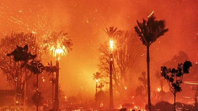






The 2020 California wildfire season, which saw over four million acres burn, was profoundly influenced by a confluence of adverse weather patterns and underlying climatic conditions. The timing and severity of California's "fire season" are inherently variable, dictated by factors such as prior winter and spring precipitation, the frequency and intensity of heat waves and wind events, and the moisture content of vegetation. In 2020, these elements
aligned in a particularly destructive manner, leading to an unprecedented scale of wildfires.
Early Season Indicators and Drought Conditions
Concerns about the 2020 fire season emerged early in the year due to unusually dry months in January and February, which were among the driest on record. This dryness raised fears of a prolonged and severe fire season. On March 22, 2020, Governor Gavin Newsom declared a state of emergency, partly due to a mass die-off of trees across the state, which further increased wildfire risk. Although consistent rain in March and April temporarily alleviated some drought conditions, Northern California was still expected to face severe wildfire conditions due to moderate or severe drought in the region. Central and Southern California were anticipated to experience serious fire conditions later in the year, influenced by a late wet season and precipitation patterns.
Climate scientists, such as Daniel Swain, predicted in June 2020 that the Arizona wildfire season, driven by similar drought and weather conditions, could foreshadow what was to come in California. This early outlook proved accurate, as the state soon faced a series of intense and widespread blazes.
Lightning Strikes and Tropical Storm Remnants
A critical turning point in the 2020 season occurred in mid-August with a siege of dry lightning across Northern California. These rare, massive summer thunderstorms were a result of an unusual combination of very hot, dry air at the surface, dry fuels, and the advection of moisture from the remnants of Tropical Storm Fausto northward into the Bay Area. Between August 14 and 16, Northern California experienced record-breaking warm temperatures due to anomalously strong high pressure. The National Weather Service issued a Fire Weather Watch, later upgraded to a Red Flag Warning, highlighting the risk of abundant lightning.
The weakening Tropical Storm Fausto provided a plume of moist, unstable air that streamed from up to 1,000 miles off the Baja Peninsula into Northern California. This moisture interacted with a high-pressure ridge over Nevada, which was already causing a long-track heat wave across much of California and the West. The collision of these weather systems generated massive thunderstorms, rare for California, which produced extensive dry lightning with little to no rain. Early on August 16, around 2,500 lightning strikes hit the Bay Area, with 200 strikes occurring in just 30 minutes. Over the next 72–96 hours, more than 12,000 lightning strikes were recorded over Northern California, sparking up to 585 wildfires that rapidly grew due to parched brush.
Heatwaves, Winds, and Explosive Growth
In early September 2020, a combination of a record-breaking heat wave and strong katabatic winds, including the Jarbo, Diablo, and Santa Ana winds, caused explosive fire growth. These winds fanned existing fires and contributed to the rapid expansion of complexes like the August Complex and the North Complex. The August Complex, for instance, became California's largest recorded wildfire, burning over one million acres. The extreme heat, low humidity, and strong winds created critical fire weather conditions that overwhelmed suppression efforts and led to widespread destruction. The severity and duration of peak fire activity in both Northern and Southern California are significantly modulated by such weather events, with downslope/offshore wind events leading to critical fire weather, while onshore flow and Pacific weather systems can help to hamper wildfire growth.