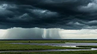


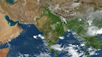


What Exactly Is an Offshore Trough?
You often hear meteorologists mention troughs, but what are they? An offshore trough is an elongated area of low pressure that forms over the sea, parallel to the coastline. During the southwest monsoon, this feature typically develops in the Arabian
Sea, running anywhere from the Gujarat coast down to Kerala. Think of it as a channel that helps gather moisture-laden winds. This convergence of moist air, combined with the trough's inherent upward motion, leads to the formation of dense clouds. When these clouds are pushed towards land by strong westerly monsoon winds, they can unleash prolonged and intense rainfall along the coastal belt.
Current Path and IMD Alerts
According to the latest IMD bulletins, this trough is currently active off the coast, influencing weather patterns significantly. Widespread rainfall is expected over Konkan & Goa for the next week, with isolated heavy spells predicted between June 29th and 30th. The intensity is forecast to increase, with very heavy rainfall likely in Konkan & Goa from July 1st to 4th. Kerala is also on high alert, with predictions for heavy to very heavy rainfall on June 29th. Other states like Coastal Karnataka will also experience widespread rains, with heavy spells likely.
State-by-State Impact and Advisories
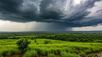
For residents along the western coast, this means preparing for a significant wet spell. In Maharashtra and Goa, the IMD has warned of fairly widespread to widespread rainfall. Heavy rain is expected in Konkan, Goa, and Madhya Maharashtra from June 29th, with the possibility of thunderstorms, lightning, and gusty winds reaching 40-50 kmph. Authorities advise against venturing into the sea and caution about potential waterlogging and transport disruptions in low-lying urban areas. In Karnataka and Kerala, similar conditions are expected. Coastal Karnataka is bracing for heavy rain on June 29th, while Kerala & Mahe could see very heavy showers. Residents in hilly areas should be particularly cautious about the risk of landslides.
Context of the 2026 Monsoon
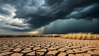
This active spell comes after a notably dry start to the season. June 2026 was one of the driest in recent history for many parts of India, with the monsoon stalling for nearly two weeks after its initial onset. The country as a whole registered a significant rainfall deficit in June. A number of factors contributed to this, including the emergence of an El Niño and a weak Somali Jet, which transports moisture from the Arabian Sea. The current trough and associated cyclonic circulations are part of a larger revival of the monsoon, which is crucial for replenishing water reservoirs and for agriculture, even as forecasters predict a below-normal season overall.
How to Stay Safe and Informed
With heavy rain forecast, it is vital to take precautions. The IMD advises residents to follow traffic advisories and avoid areas prone to waterlogging. Check for updates before starting any journey, as transport could be affected. Ensure that emergency kits are ready and stay away from vulnerable structures that could be damaged by strong winds or heavy rain. For the most accurate and up-to-date information, regularly check the official website and social media handles of the India Meteorological Department (mausam.imd.gov.in) and listen to advisories from local civic bodies and disaster management authorities. They provide district-specific warnings and guidance.