







ISRO's Eyes on the Ocean
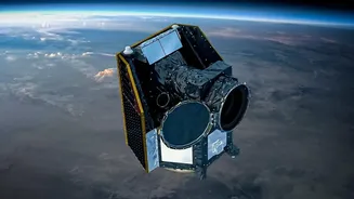
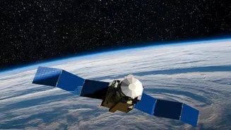
The OceanSat series of satellites are Indian-built Earth observation spacecraft dedicated to oceanography and atmospheric studies. The latest in this lineage, OceanSat-3 (also known as EOS-06), launched in November 2022, represents a significant leap
in capability. Orbiting the Earth in a polar sun-synchronous orbit, it provides continuity for services from its predecessors while enhancing the data available for scientific and operational use. The primary goal of these satellites is to continuously monitor our oceans, gathering data that is vital for both economic prosperity and the safety of coastal communities. Equipped with sophisticated sensors, the OceanSat series is a cornerstone of India's 'Blue Economy' aspirations, turning space-age technology into real-world benefits on the ground and at sea.
Guiding Fishermen to Richer Waters
One of the most impactful applications of OceanSat data is the generation of Potential Fishing Zone (PFZ) advisories. The satellite's Ocean Colour Monitor (OCM) instrument is key to this process. The OCM can detect the concentration of chlorophyll, the pigment found in phytoplankton, which are microscopic marine algae. Since phytoplankton form the base of the marine food chain, areas with high chlorophyll concentration are often teeming with fish. The Indian National Centre for Ocean Information Services (INCOIS) uses this chlorophyll data, along with sea surface temperature measurements, to identify and map these nutrient-rich areas. These maps, or PFZ advisories, are then disseminated to fishing communities, effectively giving them a treasure map to the most promising fishing grounds.
The Economic and Environmental Impact
For the average fisherman, the PFZ advisories are transformative. Instead of spending hours and burning expensive fuel searching randomly for fish shoals, they can head directly to the identified zones. This dramatically reduces search times and operational costs, leading to a significant increase in the catch per unit of effort. Studies have shown that net profits for fishermen using these advisories can increase by two to five times. Beyond the economic benefits, this targeted approach has a positive environmental impact. The significant reduction in diesel consumption lowers carbon emissions. Furthermore, the service helps promote sustainable fishing by helping authorities guide fishermen towards under-exploited species, preventing the over-exploitation of others.
Forecasting Destructive Weather Fronts
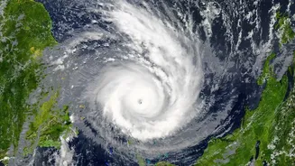
The other critical role of the OceanSat series is weather forecasting, particularly the tracking of cyclones. This is primarily handled by an instrument called a scatterometer. OceanSat-3 is equipped with an advanced Ku-Band scatterometer (SCAT-3) that measures wind speed and direction over the ocean surface with high resolution. This data is invaluable for meteorologists as it helps them detect the formation of low-pressure areas and cyclonic vortices over the vast, data-sparse ocean. By continuously monitoring the surface winds, the satellite provides the earliest possible indications of a developing cyclone, long before it poses a threat to the coast.
From Data to Life-Saving Alerts
The wind data from the scatterometer, combined with sea surface temperature and other atmospheric data, is fed into sophisticated numerical weather prediction models. This allows agencies like the National Centre for Medium Range Weather Forecasting (NCMRWF) and the India Meteorological Department to accurately forecast a cyclone's track, intensity, and potential landfall location with increasing lead time. This enhanced forecasting capability is crucial for disaster management authorities. It enables them to issue timely warnings, plan for evacuations, and preposition resources, drastically improving the preparedness of coastal populations. The ability to track weather fronts with such precision has been instrumental in saving countless lives and minimizing property damage along India's vulnerable coastlines.