





A New Vantage Point: India’s Watcher in the Sky
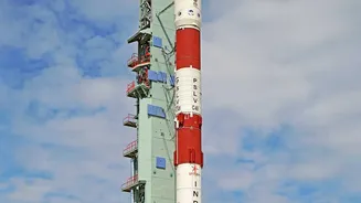
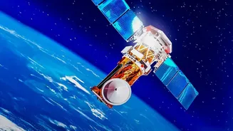
Set for launch in early September 2026, EOS-05, also known as GISAT-1A, is not just another satellite; it's India's first imaging satellite in a geostationary orbit. Most Earth observation satellites circle the globe in Low Earth Orbit (LEO), passing
over a specific location only periodically. EOS-05 is different. It will be positioned approximately 36,000 kilometres above the Earth, matching the planet's rotation. This allows it to remain stationary over the Indian subcontinent, acting like a dedicated celestial watchtower. Instead of fleeting glimpses, Indian agencies will get a continuous, dedicated view of the entire country and its surrounding oceans, a capability that is fundamentally new for India's disaster monitoring infrastructure.
The Power of a Persistent Stare
The true advantage of EOS-05 lies in its frequency of observation. The satellite is designed to be agile, capable of imaging the entire Indian landmass every 30 minutes and targeting specific areas of interest with a new image every five minutes. This near-real-time monitoring is a massive leap forward. For disaster management agencies, speed is everything. During a rapidly evolving crisis, such as a cyclone moving towards the coast or a forest fire spreading through a valley, waiting hours for a satellite pass is not an option. EOS-05’s ability to provide a constant stream of data means that agencies like the National Disaster Management Authority (NDMA) can track events as they unfold, enabling quicker, more informed decisions on evacuations, resource deployment, and public warnings.
Tracking Fast-Moving Crises
The satellite's capabilities are particularly suited for monitoring fast-developing natural disasters. For cyclones, EOS-05 can observe the storm's formation and track its path with high frequency, providing crucial data for prediction models before it is obscured by landfall clouds. In the case of forest fires, which can spread uncontrollably in minutes, the satellite can deliver rapid updates on the fire’s perimeter and direction, guiding firefighting teams on the ground more effectively. It can also monitor other large-scale events like agricultural changes, shifts in water bodies, and environmental conditions, providing a comprehensive dataset for both immediate response and long-term planning.
Assessing the Aftermath
While the satellite's primary strength is monitoring, its role post-disaster is just as critical. After a major flood or landslide, once the skies clear, EOS-05 can be tasked to rapidly map the extent of the damage. For floods, it can delineate the precise boundaries of inundated areas, identifying cut-off villages and submerged infrastructure. For landslides, it can help assess the scale of the slip and its impact on roads and settlements. This comprehensive overview allows relief agencies to prioritise rescue and aid efforts, directing resources to the hardest-hit areas with a level of accuracy that is impossible to achieve from the ground alone in the immediate aftermath.
A Key Piece in a Larger Puzzle
It is important to note that EOS-05 operates with optical sensors, meaning its view can be obscured by heavy cloud cover, a common feature during cyclones and monsoons. This is why it isn't a silver bullet, but rather a powerful new component in India’s multi-layered satellite monitoring system. Its data will complement information from radar imaging satellites, such as those from the RISAT series and the upcoming joint ISRO-NASA mission NISAR, which can see through clouds and darkness. By combining high-frequency optical data from EOS-05 with all-weather radar data, Indian agencies will have a more complete and resilient picture of any crisis, leveraging the strengths of each technology to cover the weaknesses of the other.