





The Magic of the Geostationary Arc
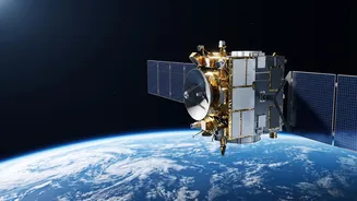
An orbit approximately 36,000 kilometres above the Earth's equator is known as a geostationary or geosynchronous orbit (GEO). The physics are elegant: at this specific altitude, a satellite's orbital period matches the Earth's rotation exactly—one sidereal
day. The result is that from the ground, the satellite appears to be fixed in the same spot in the sky. This unique property, initially popularised for telecommunications and weather forecasting, is now a cornerstone of modern military and intelligence strategy. For a country like India, with its complex geopolitical landscape and challenging frontiers, this high ground provides a powerful strategic asset.
The Unblinking Eye: Persistent Surveillance
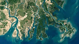
The primary strategic advantage of a GEO satellite is its ability to provide persistent, 24/7 monitoring of a specific area. Unlike satellites in Low Earth Orbit (LEO), which circle the globe every 90 to 120 minutes and can only see a specific point for a few minutes at a time, a geostationary satellite offers an 'unblinking eye'. For border monitoring, this is a revolutionary capability. It allows defence agencies to watch for slow-moving troop build-ups, the construction of new infrastructure in remote areas, or patterns of infiltration along sensitive corridors. This continuous watch makes it significantly harder for adversaries to conceal their activities, as they can no longer simply wait for a LEO satellite to pass overhead before resuming work. Recent reports indicate India is actively enhancing these capabilities, with ISRO planning launches like the EOS-05 imaging satellite specifically for this orbit.
A God's-Eye View: Wide Area Coverage
From its lofty perch at 36,000 km, a single geostationary satellite has a massive field of view. It can observe roughly one-third of the Earth's surface at once, covering entire continents or oceans. This wide-area coverage is immensely valuable for monitoring India's long and varied borders, from the high Himalayas to the dense jungles of the Northeast and the vast Thar Desert. Instead of needing a large constellation of satellites to cover the same area, a single GEO satellite can provide a comprehensive, big-picture view. This allows military planners to understand regional dynamics and deploy other assets, like drones or ground patrols, more effectively based on the intelligence gathered from this wide-angle perspective.
The LEO Contrast: Speed vs. Stamina
Satellites in Low Earth Orbit, which fly at altitudes below 2,000 km, do offer their own advantages. Their proximity to Earth allows them to capture much higher-resolution images, providing detailed close-ups that are crucial for identifying specific types of military hardware or individuals. However, their key limitation is their speed and limited field of view. They are like fast-moving spotlights, providing excellent detail but for very brief periods. A geostationary satellite, in contrast, is like a permanent floodlight. While its images may have lower resolution due to the immense distance, its strength lies in persistence and context. The most effective surveillance architecture often involves a combination of both: GEO satellites to detect anomalies over a wide area and then tasking LEO satellites to get a high-resolution look at the specific point of interest.
From Theory to Tactical Advantage
India's push for greater space-based surveillance is not an abstract exercise. The country plans to launch dozens of advanced surveillance satellites to create a comprehensive security network. These systems are designed to provide all-weather, day-and-night monitoring capabilities, crucial for piercing cloud cover or observing movements after dark. By positioning imaging satellites in geostationary orbit, Indian security forces gain the ability to conduct real-time monitoring of strategic choke points and adversary movements without interruption. This provides critical early warning, allowing for quicker diplomatic or military responses and fundamentally strengthening India's deterrent posture along its borders. It transforms surveillance from a series of snapshots into a continuous, live intelligence feed, offering undeniable strategic superiority.