


A New Eye on the Frozen Continent
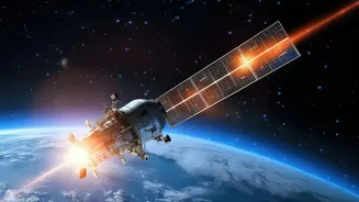
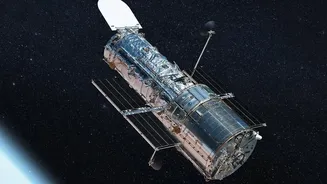
The NASA-ISRO Synthetic Aperture Radar, or NISAR, is not just another satellite. Launched in July 2025, it is one of the most sophisticated Earth-observing platforms ever built, a testament to international collaboration between the American and Indian
space agencies. Its primary goal is to provide an unprecedentedly detailed view of our planet's complex processes, from ecosystem disturbances to the collapse of ice sheets. Unlike optical satellites that require sunlight and clear skies, NISAR can see day or night, through clouds and storms, making it perfectly suited for the challenging environment of Antarctica. The mission will map nearly all of Earth's land and ice surfaces twice every 12 days, tracking changes with astonishing precision.
Seeing Through Ice with Radar
NISAR’s superpower lies in its advanced radar technology. The satellite carries two distinct radar systems, L-band and S-band, which send microwave signals toward the planet's surface and analyze the echoes that bounce back. This method allows it to detect changes on the ground as small as a centimetre. Most importantly for Antarctic research, the radar waves can penetrate snow and ice, revealing the structure and texture of the surfaces beneath. Scientists can interpret how the radar signals scatter to understand the difference between smooth, solid ice and areas that are fractured or rough. A recent stunning image, nicknamed "the hummingbird" by scientists, showcased this ability by revealing a pattern of deep cracks, or crevasses, in the ice flowing around a hidden mountaintop. These features are nearly invisible to standard optical satellites, which see only a uniform white surface.
Uncovering Ice Sheet Secrets
The data from NISAR is providing a dynamic new view of how Antarctica's vast ice sheets behave. By using polarized radar waves, the satellite can distinguish between different types of ice surfaces. In the "hummingbird" image, for example, smooth ice appears as magenta, while the rough, fractured walls of crevasses show up as green. This allows scientists to map stresses and strains within the glaciers in incredible detail. They can see exactly where the ice is breaking up as it flows toward the ocean. Tracking these movements is crucial, as the stability of glaciers in regions like West Antarctica is one of the biggest uncertainties in predicting future sea-level rise. NISAR's ability to monitor these remote, fast-changing areas provides an essential tool for understanding the processes that could have global consequences.
Mapping the Land Below
Beyond the ice itself, NISAR is revealing the hidden geology of the Antarctic continent. The mission can map the topography of the land buried beneath kilometres of ice. For instance, the striking "hummingbird" pattern was formed by a glacier flowing around an obstacle: a rocky mountaintop, known as a nunatak, that pokes through the ice sheet. The mountain's presence puts enormous stress on the surrounding ice, causing it to fracture. By identifying these hidden geological features, scientists can better understand the pathways glaciers follow and the factors that might speed up or slow down their journey to the sea. This information helps build more accurate models of the entire ice-sheet system and its potential contribution to changes in global sea level.
From Polar Data to Global Impact
The discoveries NISAR is making in Antarctica are more than just scientific curiosities. The mission is designed to address some of the most critical environmental challenges of our time, including the impacts of climate change. Understanding the dynamics of ice sheets, monitoring natural hazards like earthquakes, and tracking changes in ecosystems are all part of its broad mandate. The data, which became publicly available in July 2026, will be used by researchers worldwide to refine climate models and improve disaster response. For a country like India, with its extensive coastline, understanding the precise rate of sea-level rise driven by polar ice melt is of immense national importance. NISAR provides a vital stream of information to help prepare for the future.