

What is NISAR and Why is This a Big Deal?
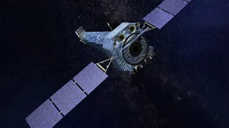
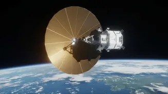
NISAR is a joint Earth-observation mission between NASA and the Indian Space Research Organisation (ISRO), and it's unlike any satellite before it. It's the world's first dual-frequency radar satellite, using both L-band and S-band radar to map nearly
all of Earth's land and ice surfaces twice every 12 days. Think of it as giving our planet a regular, detailed check-up. The most exciting part? This incredibly valuable data is being made available to the public. Provisional data from June and July 2026 has already been released, with more to come. For students, researchers, and hobbyists in India, this means you now have free access to a state-of-the-art tool that can see through clouds and darkness to monitor everything from crop health to the slow creep of a landslide.
Getting Your Hands on the Data
Accessing this treasure trove of information is surprisingly straightforward. The data is available through multiple online portals. ISRO is providing access to S-band data via its Bhoonidhi data portal. For the L-band data, you can turn to NASA's platforms like the Alaska Satellite Facility (ASF) DAAC and NASA Earthdata Search. To get started, you'll typically need to create a free account, like an Earthdata Login. These portals allow you to search for data by location, date, and product type. For those with some programming skills, you can even automate downloads using Python packages and APIs provided by the data centers, which is perfect for larger, more complex projects.
Project Idea 1: Mapping Urban Sprawl
Indian cities are growing at a phenomenal rate. But how do you measure that growth accurately? This is a perfect project for NISAR. Using data captured over several months, you can track the changing face of a city like Hyderabad, Bengaluru, or the NCR. Synthetic Aperture Radar (SAR) is excellent at distinguishing between different types of surfaces. Buildings, roads, parks, and water bodies all reflect the radar signal differently. By comparing images from different dates, you can create a time-lapse map showing exactly where new construction is happening. This kind of analysis is invaluable for urban planners and can form the basis of a powerful science fair project or undergraduate research paper.
Project Idea 2: Monitoring Agricultural Health
Agriculture is the backbone of the Indian economy, and NISAR provides a powerful new way to monitor it. The satellite's S-band radar is particularly sensitive to light vegetation and crop monitoring. You could select a key agricultural region, such as the rice paddies of West Bengal or the wheat fields of Punjab, and track the entire crop cycle. The data can reveal information about soil moisture, vegetation density, and even the impact of irrigation. A potential project could be to compare the health of crops in an area with good monsoon rainfall versus an area experiencing drought, using NISAR data to quantify the difference. This moves beyond simple observation into real data-driven analysis.
Project Idea 3: Assessing Disaster Impact
From cyclones on the east coast to flooding in Assam and Kerala, India is no stranger to natural disasters. NISAR is a game-changer for disaster management because radar can see through the cloud cover that often accompanies these events. Special 'Urgent Response' data can be made available quickly after a major event. A compelling student project would be to conduct a before-and-after analysis of a flood-affected area. By comparing a pre-flood image with one taken during or immediately after, you can map the exact extent of the inundation. This information is critically important for rescue and relief efforts and provides a tangible way to use space technology for social good.