





A River of Silt
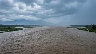
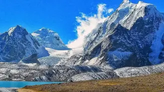
The primary source of the Kosi's danger begins high in the Himalayas. As the river carves its path through this young and fragile mountain range, it picks up an astonishing amount of silt. It is estimated to carry one of the highest sediment loads of any
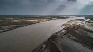
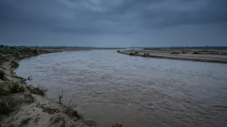
river in the world, depositing between 100 to 135 million tonnes of silt, sand, and debris annually into the plains of Nepal and Bihar. While the Kosi basin makes up only about 9% of the larger Ganges river system, it contributes nearly 25% of its total sediment. This immense silt load is the root cause of all its other dangerous characteristics. The river simply carries more solid material than it can effectively transport to the sea, leading to constant deposition along its path.
A Constantly Shifting Path
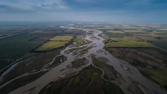
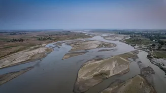
This massive sediment deposit forces the Kosi to constantly change its course, a phenomenon known as avulsion. As silt builds up on the riverbed, the water level rises until it breaches its banks and carves a new, lower path. This process is not gradual; it can be sudden and catastrophic. Over the last 250 years, the Kosi has shifted its course westward by an astounding 120 kilometres, leaving behind a massive alluvial fan of deposits stretching over 15,000 square kilometres. This unpredictable movement means that villages and farms that were once considered safe can suddenly find themselves in the direct path of a raging river, making long-term settlement and agriculture a perilous gamble.
The 2008 Catastrophe: A Case Study
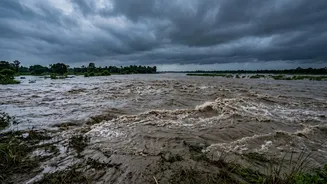
The devastating potential of the Kosi was tragically realised in August 2008. A breach in an embankment near the Indo-Nepal border caused the river to abandon its established channel and violently shift its course, flooding areas that had not seen such a disaster in decades. The breach unleashed a torrent of water that affected over 2.3 million people in Bihar, destroying hundreds of thousands of homes, ruining vast tracts of farmland, and causing hundreds of deaths. The 2008 flood was a stark reminder that engineering solutions were not foolproof and that the river's natural tendencies remained a powerful and present danger. It highlighted the immense vulnerability of the millions living on the Kosi's vast alluvial plain.
The Embankment Paradox
To control the Kosi's destructive floods, extensive embankments were built along its banks in the 1950s. The idea was simple: confine the river to a single channel. However, this has created an 'embankment paradox'. By trapping the river, the embankments also trap its massive sediment load. This causes the riverbed to rise steadily year after year. Consequently, the Kosi now flows at a level significantly higher than the surrounding plains, creating a 'superelevated' river. While the embankments offer protection during normal flows, they make any potential breach even more catastrophic, as the elevated river would pour down onto the floodplain with immense force. Furthermore, these structures have failed repeatedly over the decades, leading to major floods in 1968, 1984, 1991, and most infamously, 2008.
A Transboundary Challenge
Managing the Kosi is not just an engineering problem; it is a complex geopolitical one. The river's catchment area lies in Tibet (China) and Nepal, but the most severe impacts of its flooding are felt downstream in India. The Kosi Barrage and its embankments, governed by the Kosi Agreement of 1954 between India and Nepal, require constant cooperation for maintenance and operation. However, issues of water rights, management, and accountability have sometimes caused friction between the two nations. Effective flood warnings, sediment management, and long-term solutions like a proposed high dam in Nepal are all dependent on sustained and trust-based diplomacy, making international cooperation as critical as any concrete structure in mitigating the river's danger.