




The Global Suspect: A Strong El Niño
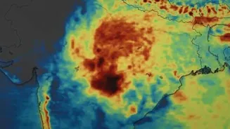
One of the primary factors at play is a strong El Niño event unfolding thousands of kilometres away in the Pacific Ocean. El Niño is a climate pattern characterized by the unusual warming of surface waters in the central and unusual warming of surface waters in the central and eastern
equatorial Pacific. This change in ocean temperature disrupts atmospheric circulation patterns globally. For India, this typically means a weaker monsoon. The warm Pacific waters can alter the normal pressure systems and wind flows that drive moisture from the Arabian Sea towards the subcontinent, effectively suppressing rainfall. Forecasters have noted that the 2026 El Niño is strengthening rapidly and is expected to become a very strong event, influencing weather patterns throughout the rest of the year. This large-scale phenomenon is a major reason why the India Meteorological Department (IMD) initially projected a below-normal monsoon for the country.
Local Factors: The Missing Monsoon Drivers
While El Niño sets the global stage, local weather systems are what turn potential into actual rainfall for Mumbai. This season, several key local drivers have been notably absent or weak. Meteorologists point to the lack of strong, active systems needed for good rain. A crucial element for heavy rainfall along the Konkan coast, including Mumbai, is a strong offshore trough—an area of low pressure that runs parallel to the coast. This trough helps pull in moisture-laden westerly winds from the sea. The weakening of these systems means less moisture is drawn inland, resulting in fewer and less intense rain spells. The monsoon's progress stalled early in the season due to these weak conditions, contributing to a delayed onset and a significant rainfall deficit in June.
A Paradox of Extremes
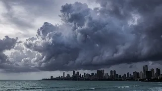
Confusingly, a weak monsoon doesn't always mean a complete lack of rain. In fact, it can lead to a paradoxical situation of long dry spells punctuated by sudden, intense downpours. This 'monsoon whiplash' was seen in parts of India this year, where some regions experienced flash floods despite an overall seasonal deficit. The 2026 monsoon has demonstrated this changing pattern; after a very dry June, some parts of the country saw a recovery in July due to the formation of low-pressure systems, but the overall distribution has been highly uneven. Scientists now argue that El Niño alone no longer explains India's rainfall behaviour. A rapidly warming Arabian Sea, influenced by broader climate change, is making rainfall events shorter but more intense, increasing the risk of urban flooding even in a drier-than-average year.
The Impact on the City
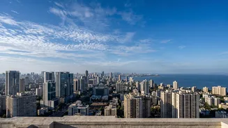
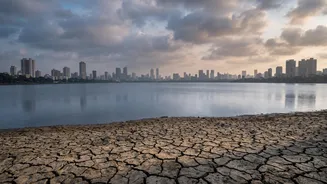
The tangible consequences of a weak monsoon are already being felt. The delayed and deficient rains in June left the seven crucial lakes that supply Mumbai with drinking water at critically low levels, falling to less than 9% of their required capacity at one point. This forced the Brihanmumbai Municipal Corporation (BMC) to implement water cuts across the city to manage dwindling stocks. While some heavy spells in July provided temporary relief, the IMD has forecast below-normal rainfall for August and the remainder of the season. This shortfall has significant implications not just for the city's water supply but also for agriculture in the surrounding regions, which depend heavily on consistent monsoon rains. The weak season is a stark reminder of the city's vulnerability to the whims of the weather.