







The View from Above
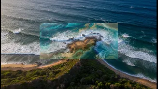
Satellites provide a perspective that is impossible to gain from the ground. They are crucial for monitoring large-scale environmental changes. From space, researchers can track coastal erosion, measure rising sea levels, monitor the health of mangrove
forests and coral reefs, and detect large algal blooms. This technology offers quantitative data over immense areas, allowing scientists to identify broad trends and patterns that might otherwise go unnoticed. For a country like India, with over 7,500 kilometres of coastline, this large-scale monitoring capability is invaluable for understanding the widespread impacts of climate change. Satellite data can provide an early warning system for everything from cyclone intensity to long-term shoreline retreat, forming a critical baseline for environmental management.
Generations of Ground Truth
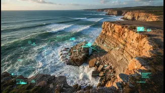
While satellites see the big picture, Indigenous knowledge provides the depth and context that data alone cannot. For millennia, coastal communities have developed a sophisticated understanding of their local ecosystems. This Traditional Ecological Knowledge (TEK) includes nuanced observations of wind and current patterns, the life cycles of marine species, and subtle signs of environmental stress. It is a living library of information, passed down through generations, that often contains crucial historical context about rare events like tsunamis or unusual climate cycles that predate modern scientific records. In Tamil Nadu, for instance, the Pattinavar fishing communities possess a deep-rooted understanding of their coastal environment, which provides invaluable insights for resilience and sustainability. This knowledge is not just historical; it is a dynamic system of observation and adaptation that is essential for day-to-day survival and resource management.
A Powerful Partnership
The real breakthrough comes when these two ways of knowing—the high-tech and the traditional—are brought together. Indigenous knowledge acts as the 'ground truth' for satellite data, helping to explain the 'why' behind the 'what' that satellites observe. For example, a satellite might detect a change in nearshore water turbidity, but local fishers can explain that it is caused by a specific illegal fishing practice or changes in vessel traffic. In the Arctic, Inuit hunters' detailed knowledge of more than 30 types of sea ice helps refine satellite models, making travel safer in a rapidly changing climate. This blending of knowledge creates a much richer, more accurate picture of coastal dynamics. It turns raw data into actionable intelligence, enabling more effective and locally relevant conservation and management strategies.
What Still Needs Checking
Despite the immense potential, integrating these two systems is not without its challenges. A primary concern is creating a truly equitable partnership. For too long, scientific research has been an extractive process, taking knowledge from communities without proper recognition or benefit. Building trust, which can take a long time, is fundamental. There are also significant issues around data sovereignty—who owns the combined knowledge and how it is used. Power imbalances often persist, and there's a risk of simply tokenizing Indigenous knowledge rather than treating it as an equal and valid system. Moving forward requires creating formal frameworks for collaboration, ensuring Indigenous communities have control over their own knowledge, and decolonising the research process to foster mutual respect and genuine co-production of knowledge.