





What exactly is an Earth Observation Satellite?
Think of an Earth Observation (EO) satellite as a highly advanced camera in orbit, designed to monitor our planet. These satellites are the backbone of modern environmental monitoring, resource management, and even disaster response. They carry powerful
sensors that can capture images of the Earth's surface across different wavelengths of light, including those invisible to the human eye, like infrared. This allows scientists and authorities to track everything from weather patterns and crop health to deforestation and urban expansion. Some EO satellites use radar to see through clouds and darkness, providing all-weather surveillance capabilities. The Indian Space Research Organisation (ISRO) has a long and successful history with these satellites, starting with the Indian Remote Sensing (IRS) program in 1988.
What makes the EOS-05 mission special?
The key differentiator for EOS-05 is its orbit. Unlike most EO satellites that circle the Earth in a Low Earth Orbit (LEO), passing over a location only at specific intervals, EOS-05 operates from a geosynchronous orbit, approximately 36,000 kilometres high. At this altitude, the satellite's speed matches the Earth's rotation, allowing it to seemingly 'hover' over the Indian subcontinent. This provides the ability for near-continuous monitoring of a large geographical area. Dubbed GISAT-1A, the satellite can image the entire Indian landmass every 30 minutes and a selected region of interest every five minutes. This mission is a significant achievement, especially following the unsuccessful launch of its predecessor, EOS-03, in 2021.
How does this technology benefit India?
The applications for a satellite like EOS-05 are vast and vital for a country like India. Its ability to provide rapid, repeated imaging is a game-changer for disaster management. It can facilitate near real-time monitoring of natural disasters like floods, cyclones, and forest fires, enabling quicker and more effective response efforts. In agriculture, it will help in assessing crop health, monitoring vegetation, and managing water resources more efficiently. Urban planners can use the data to monitor land use changes and the expansion of cities. Furthermore, the data supports environmental assessment, from tracking glacier melt in the Himalayas to monitoring coastal changes.
Are there strategic and security uses?
Yes, a constant eye over the region has significant strategic implications. The ability to monitor the Indian subcontinent and its surrounding areas continuously enhances the nation's surveillance capabilities. While ISRO focuses on the civilian benefits, the 'eye in the sky' can be used for monitoring borders and keeping a watch over adjoining regions. The satellite's high-resolution cameras provide valuable data that can be used for security and strategic planning. This dual-use capability—serving both civilian and defence purposes—is a hallmark of advanced space programs and makes EOS-05 a critical national asset. Previous EO satellites, particularly the RISAT series with their radar imaging, have already established this precedent for ISRO.
What are the key technical features?
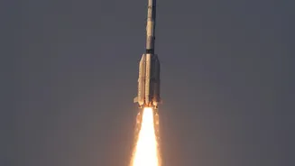
The EOS-05 is a 2,367 kg satellite launched aboard the GSLV-F17 rocket. Its primary payload consists of multi-spectral and hyperspectral imagers. These instruments capture data in various bands of the light spectrum, providing rich information that can be analysed for different purposes. For instance, one of its multispectral imagers has a resolution of 42 metres, which is exceptionally high for a camera in a geostationary orbit. This allows for detailed observation over a wide area. The satellite's design is based on the learnings from the GISAT series, aimed at providing high-temporal-resolution imagery—meaning it can take pictures of the same place very frequently.